Guide to the Reykjanes Peninsula
The Reykjanes Peninsula is a unique slice of Iceland with dramatic landscapes comprising lava fields, volcanic craters, geothermal waters and hot springs, and lava caves. The 55 sites of the Reykjanes Geopark are at the centre of it all.
The Reykjanes Peninsula is a young section of Iceland, a highly volcanic counterpart of the Mid-Atlantic Ridge, where the North American and Eurasian tectonic plates part at an average rate of a couple of centimetres a year. This is the area to explore a volcanic wonderland.
What is the Reykjanes Geopark?
Known as the home of the Blue Lagoon and recent erupting volcanoes, the Reykjanes Peninsula was recognized as a UNESCO Global Geopark in 2015. UNESCO Global Geoparks are areas where landscapes and specific sites are of international geological significance and managed with preservation, education, and sustainable development. The geopark represents Iceland’s unique geology and is a must for geology enthusiasts, hikers, and photographers.
Geology of Reykjanes
The Reykjanes Peninsula, with an area of 2,000 sq. km, comprises four volcanic systems and fissure swarms from the southwest to the northeast. They contain open fissures, faults, geothermal fields, crater rows and dormant volcanic shield mountains. Eruptions have occurred in all of the five systems during the past millennium, all in long episodes, in the 10/11th centuries, in 1151-1180, 1210-1240, and most recently in 2021 and 2022.
Attractions on the Reykjanes Peninsula
Bridge Between the Continents
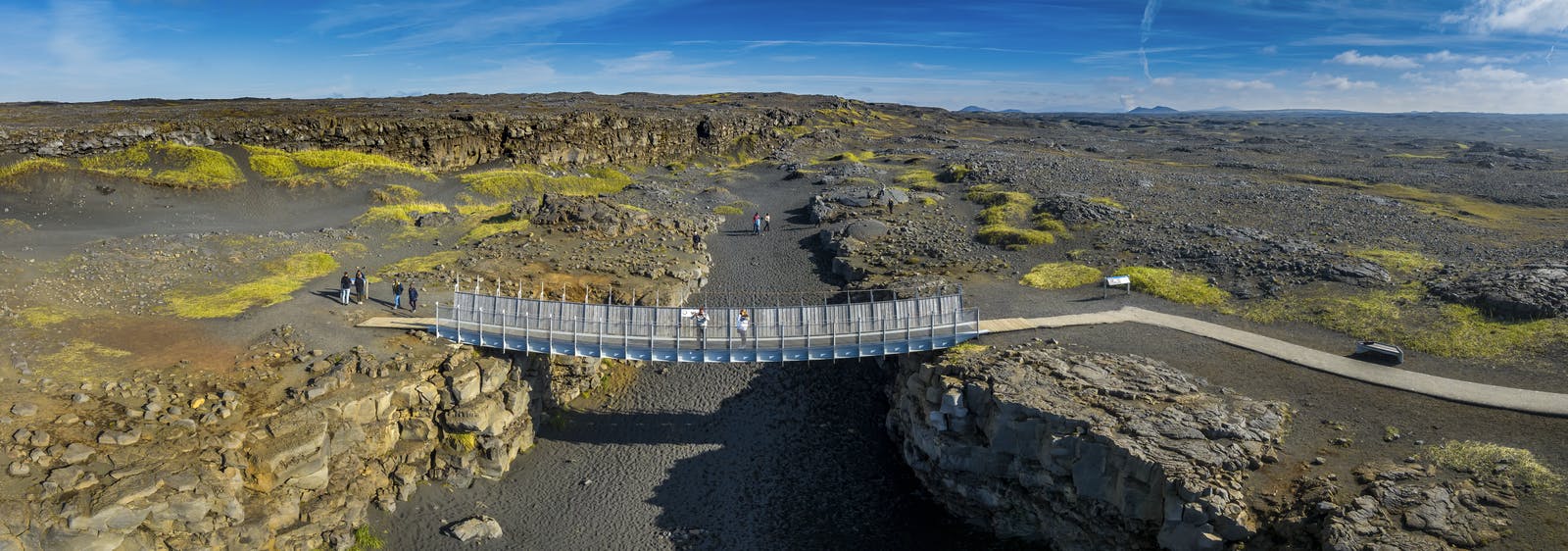
Travellers can visit a spot where the Mid-Atlantic Ridge crosses Iceland, the meeting point of the Eurasian and North American plates. There’s a small footbridge crossing an open crack in the lava field, a symbolic site that connects the two land masses, offering visitors an impressive view of the ridge.
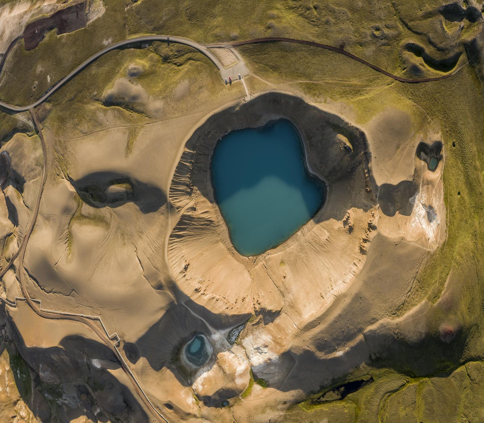
Gunnuhver
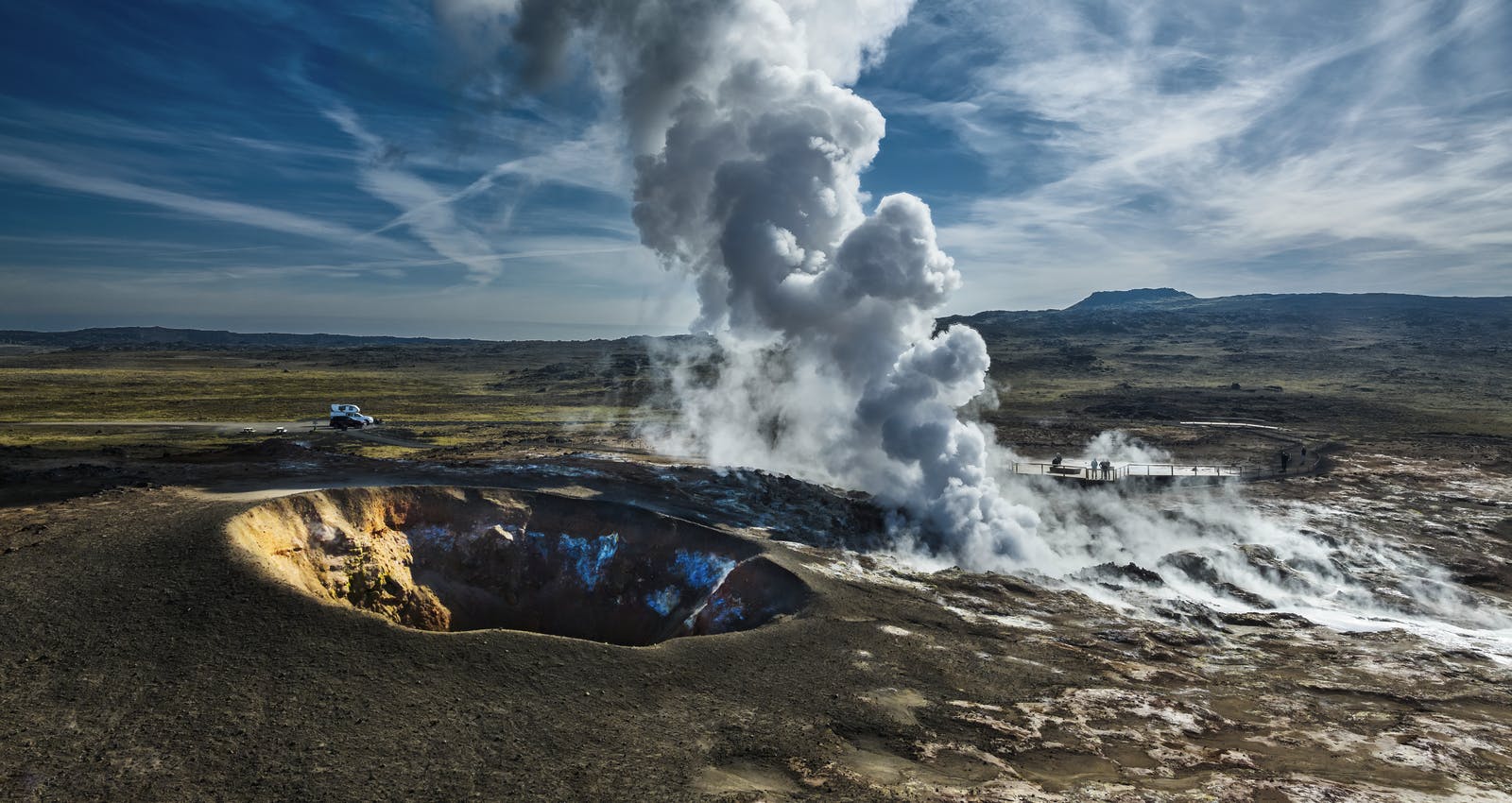
Gunnuhver is a geothermal area comprised of bubbling mud pools, hissing steam vents, and colourful mineral deposits. It is named after a legendary ghost named Gunna, and the area offers a fascinating view of Iceland’s geothermal activity.
Kleifarvatn
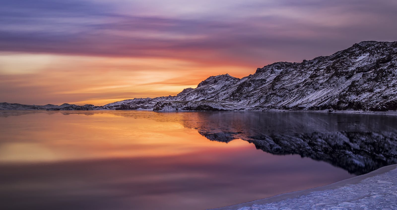
Kleifarvatn is a vast lake known for its dark, mysterious waters and spectacular volcanic surroundings. It is the largest lake on the Reykjanes Peninsula and offers locals and travellers opportunities for hiking, fishing, and birdwatching.
Seltún
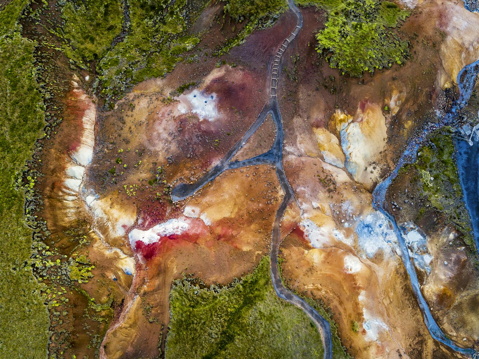
Seltún is a geothermal area in Krýsuvík, featuring an otherworldly landscape with gurgling mud pots, boiling vents, and rich mineral deposits. Wooden footpaths allow visitors to explore the geothermal features while ensuring their safety.
What is the Most Popular Attraction on the Reykjanes Peninsula?
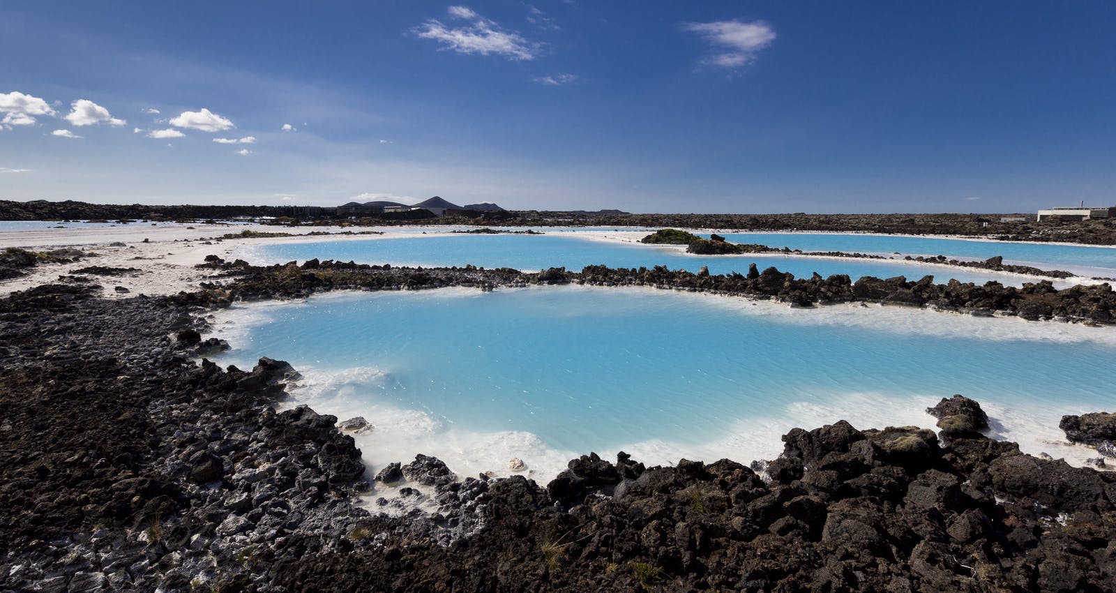
The Blue Lagoon is the most popular attraction on the Reykjanes Peninsula and arguably the most famous site in all of Iceland. Built on an 800-year-old lava field, the Blue Lagoon covers an area of 93,646 sq ft and draws visitors from around the world to soak in its gloriously milky-blue waters amid a dreamlike atmosphere. The geothermally heated water ranges between 37-39°C and is heavenly any time of year.
How to get to Reykjanes
Joining a guided tour is an excellent option if you prefer not to drive or navigate on your own. Some tour operators offer guided excursions to the Reykjanes Geopark from Reykjavik; these tours often include transportation, a knowledgeable local guide, and visits to key attractions in the geopark. While guided tours are the way for many travellers, renting a car to explore the Reykjanes Geopark is possible. You can drive to the geopark from Reykjavik by following Route 41 or Route 43, connecting the capital region to the Reykjanes Peninsula.
What part of Iceland is the Reykjanes Geopark located?
The geopark encompasses the southwestern part of the Reykjanes Peninsula, and Keflavik International Airport is on the peninsula’s western side.
Best Time to Visit Reykjanes
The Reykjanes Geopark can be a great area to visit any time of year. In summer, there could be milder temperatures, long days of sunlight, and lush green grass and moss covering the landscape. However, the winter is also a lovely time to visit the region with the soft light, possible snowy landscapes, and fewer crowds.
Recent Volcanic Eruptions on the Reykjanes Peninsula
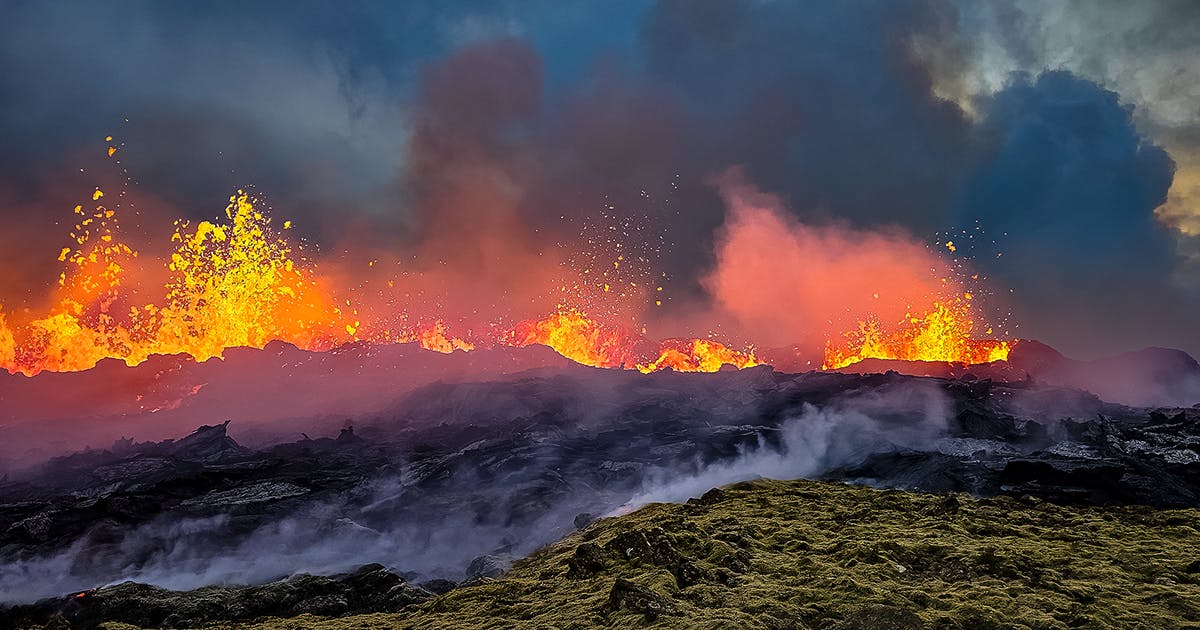
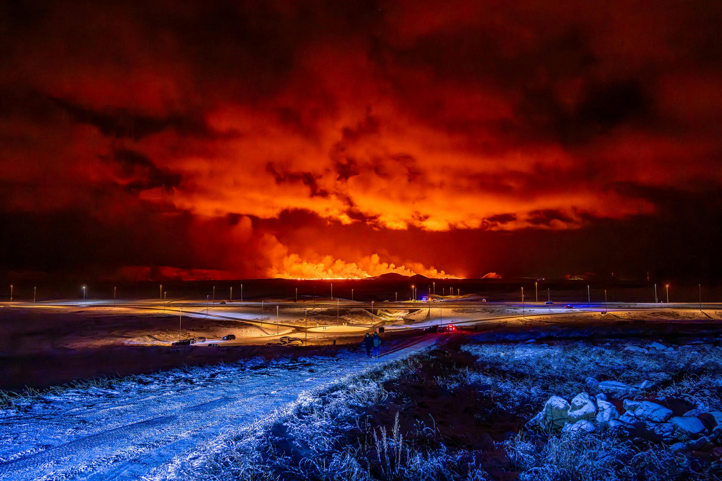
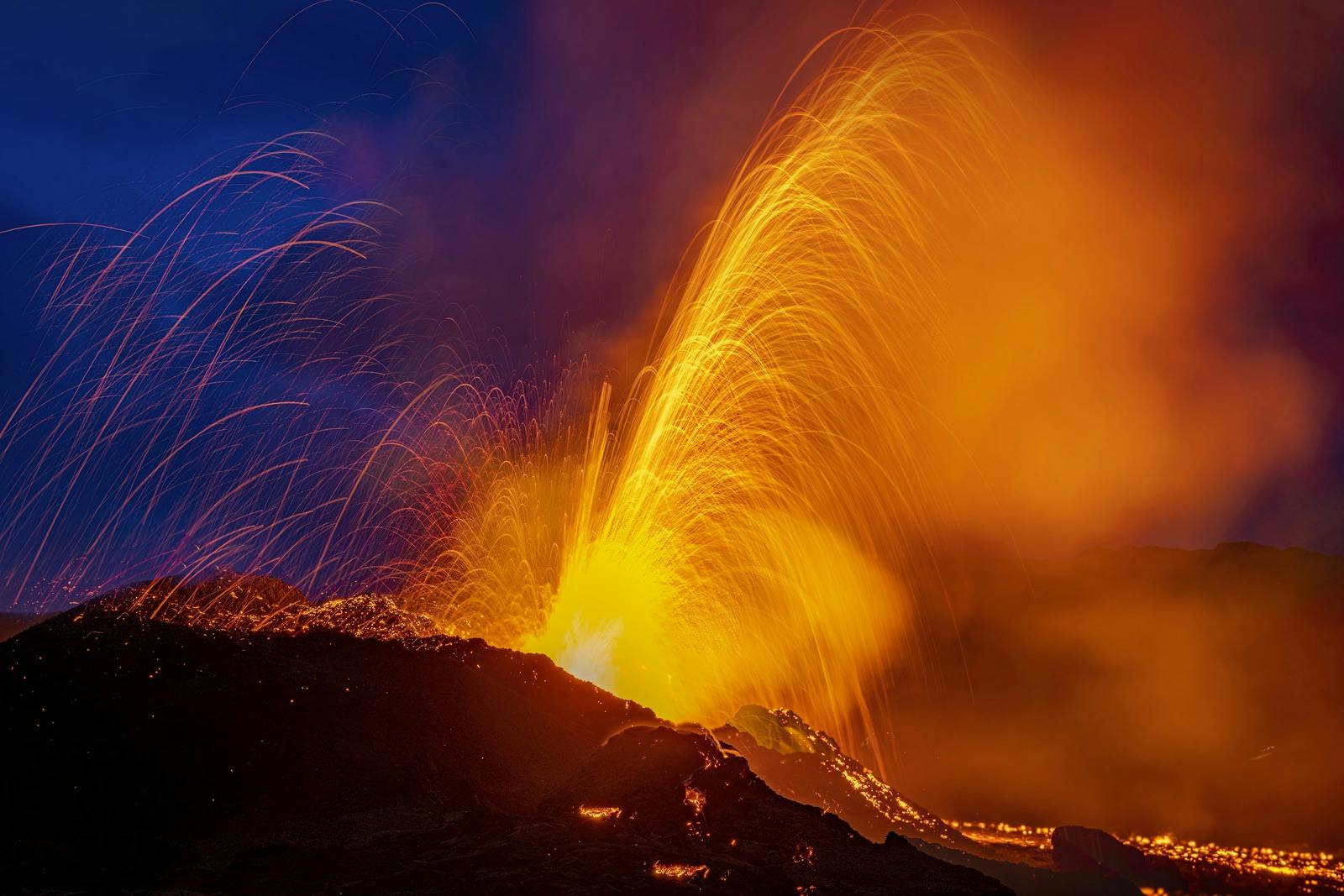
Since 2021 the Reykjanes peninsula has experienced nearly constant geological unrest with earthquakes, ground deformation and eruptions. A volcano erupted in an uninhabited part of the Reykjanes peninsula after intense earthquake activity, the third eruption in the region since 2021. Iceland’s last volcanic eruption began on the afternoon of 10 July 2023 and ended on 5 August 2023 in the Fagradalsfjall volcano system, with a 900-metre-long fissure opening up.
Just 11 months after the last eruption, the new crack sparked excitement from locals and tourists alike. The third eruption in three years, the fissure followed thousands of earthquakes over a period of several days. Magma broke through the surface, shooting fountains of lava metres into the air. The eruption site was named Litli-Hrútur (Little Ram).
There hadn’t been a volcanic eruption for 815 years on the Reykjanes Peninsula until 19 March 2021. The Fagradalsfjall volcano awakened when a fissure vent appeared in Geldingadalir to the southwest of the mountain. The 2021 eruption emitted fresh lava until 18 September 2021. Another eruption began in Merardalir nearby on 3 August 2022 and ended on 21 August 2022, similar to the 2021 eruption. A third eruption appeared just to the north of Fagradalsfjall near Litli-Hrútur on 10 July 2023.
The fourth eruption burst out near Grindavik on 18 December after severe earthquake activity and evacuation of the town. This unrest is still going on, and more eruptions are expected in the area in the coming months and years.
Where Can You Learn About Volcanoes in Iceland?
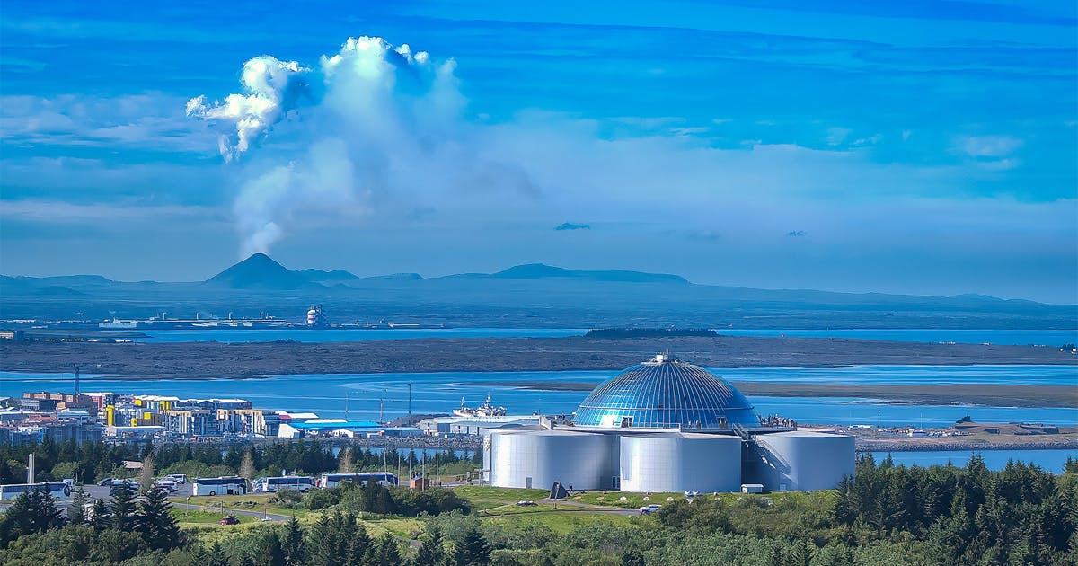
Perlan’s Forces of Nature exhibition allows guests to feel the power of volcanoes, earthquakes, and geothermal energy that powers the island. Guests will learn that volcanoes form when heat and pressure build up beneath the earth’s surface. The earth’s weak points tend to be along fault lines where tectonic plates converge or diverge, as in Iceland’s case.
Perlan’s exhibition shows that volcanic activity in Iceland is so diverse that researchers typically speak of “volcanic systems” rather than individual volcanoes. The island has 30 active volcanic systems, each with many types of volcanoes.
Popular articles
Reykjanes Volcanoes Overview
Enjoy a complete overview of the Reykjanes Volcanoes from 2021-2024. Learn about its geology, recent activity, and visitor tips for a safe, memorable experience.

Reykjanes Peninsula Volcanoes: Sundhnúksgígar Eruptions
The anticipated volcano has erupted in the Reykjanes Peninsula, the site is being called Sundhnúkagígar. See the historic insights on the seismic activity and volcanic eruptions.
Earthquakes in Iceland
Earthquakes in Iceland are a fact of life. Each year, hundreds of small tremors shake the earth, a reminder of the country’s position on a tectonic plate boundary.
Volcano Museums and Exhibitions in Iceland
If you don't manage to visit an actively erupting volcano in Iceland - Experience its force at one of these excellent volcano museums and exhibitions in Iceland.

Top 10 Places To See the Northern Lights in Iceland
You can see the northern lights across the country, but some spots are more suitable than others. Find the best place to see the northern lights in Iceland.

Ice Caves From Reykjavik
Travel beyond the capital for a closer look at an ice cave under one of Iceland’s glaciers. If you can’t spare the time, experience Perlan’s ice cave in Reykjavik.