

Sundhnúkagígar Crater Row Volcanic Eruptions
June 2026 Update
Ground uplift and magma accumulation continue beneath Svartsengi. Around 27.5 million cubic metres of magma have accumulated since around mid-July last year, making it the largest build-up measured between eruptions in the current volcanic cycle.
Authorities note that a new magma intrusion and possible eruption along the Sundhnúkur crater row remains the most likely scenario.
Svartsengi is essentially the magma reservoir and pressure source, while Sundhnúkagígar is the eruption site. It is the area north of Grindavík on the Reykjanes Peninsula, home to the Svartsengi geothermal power plant and located adjacent to the Blue Lagoon.
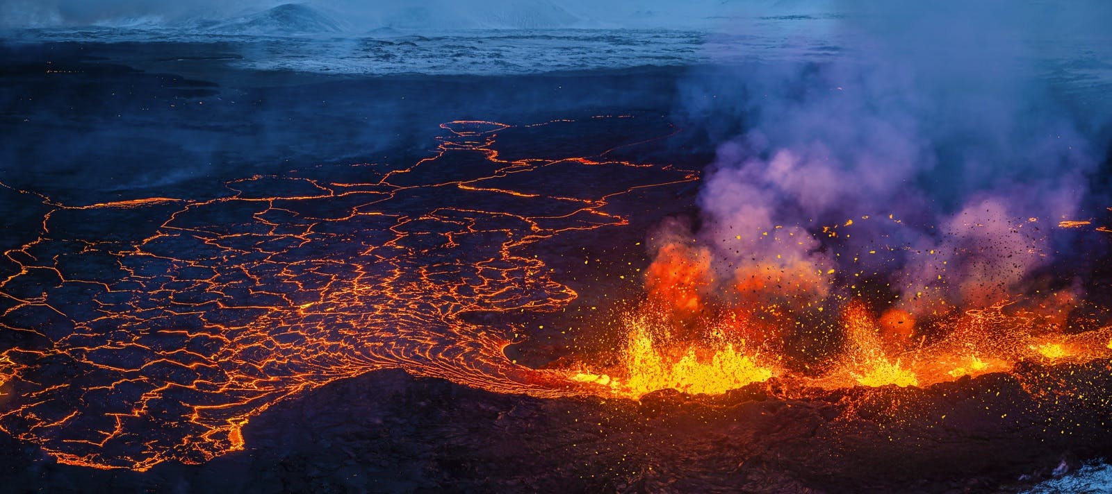
July Eruption 2025
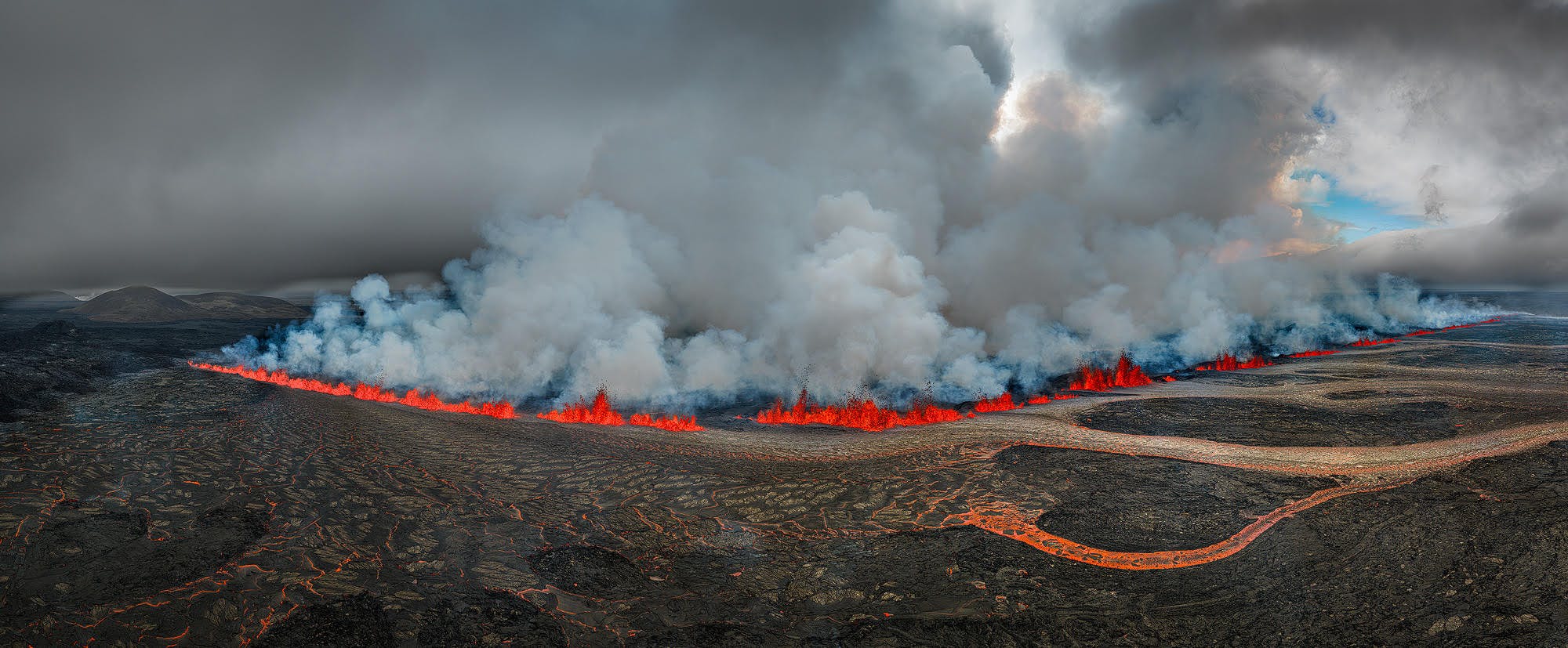
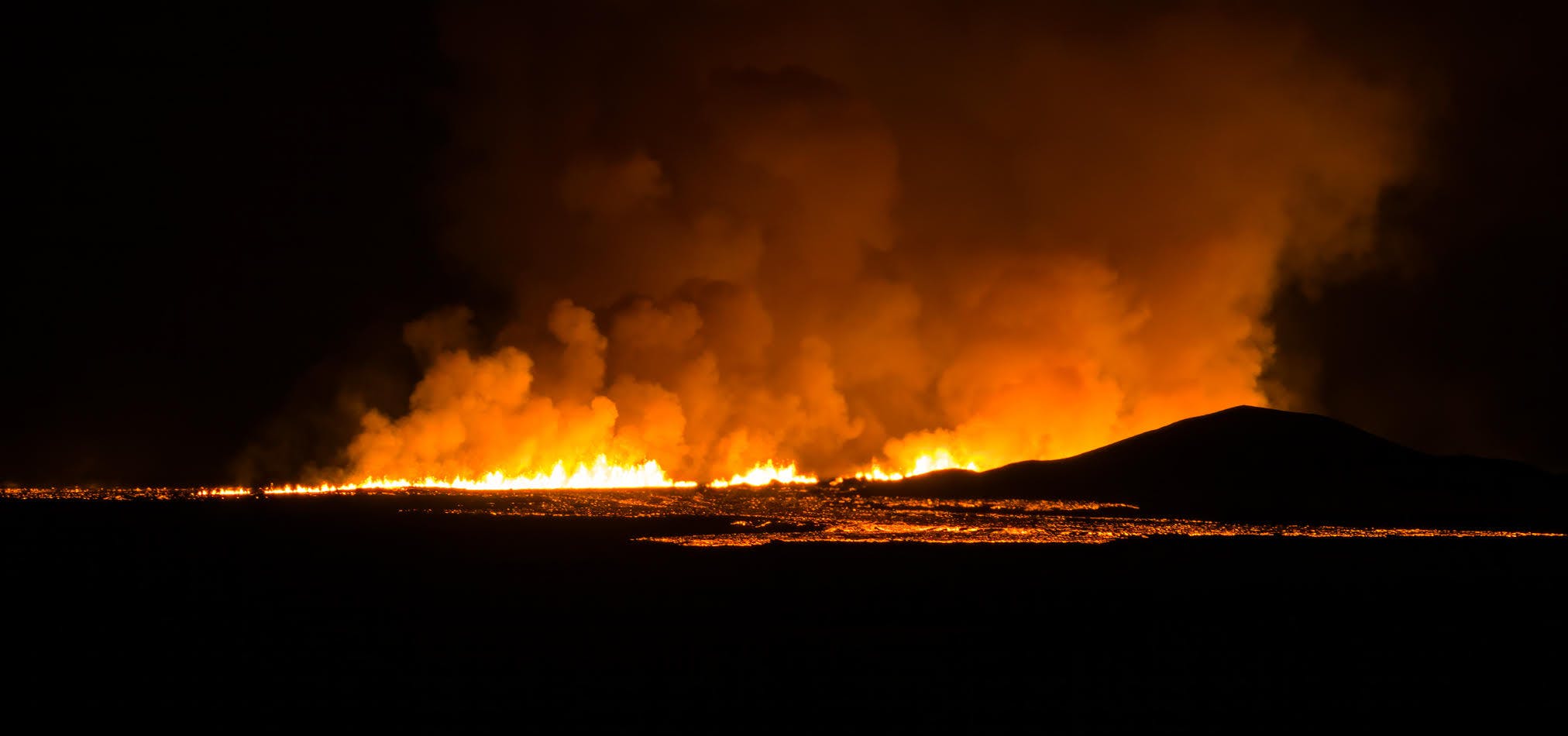
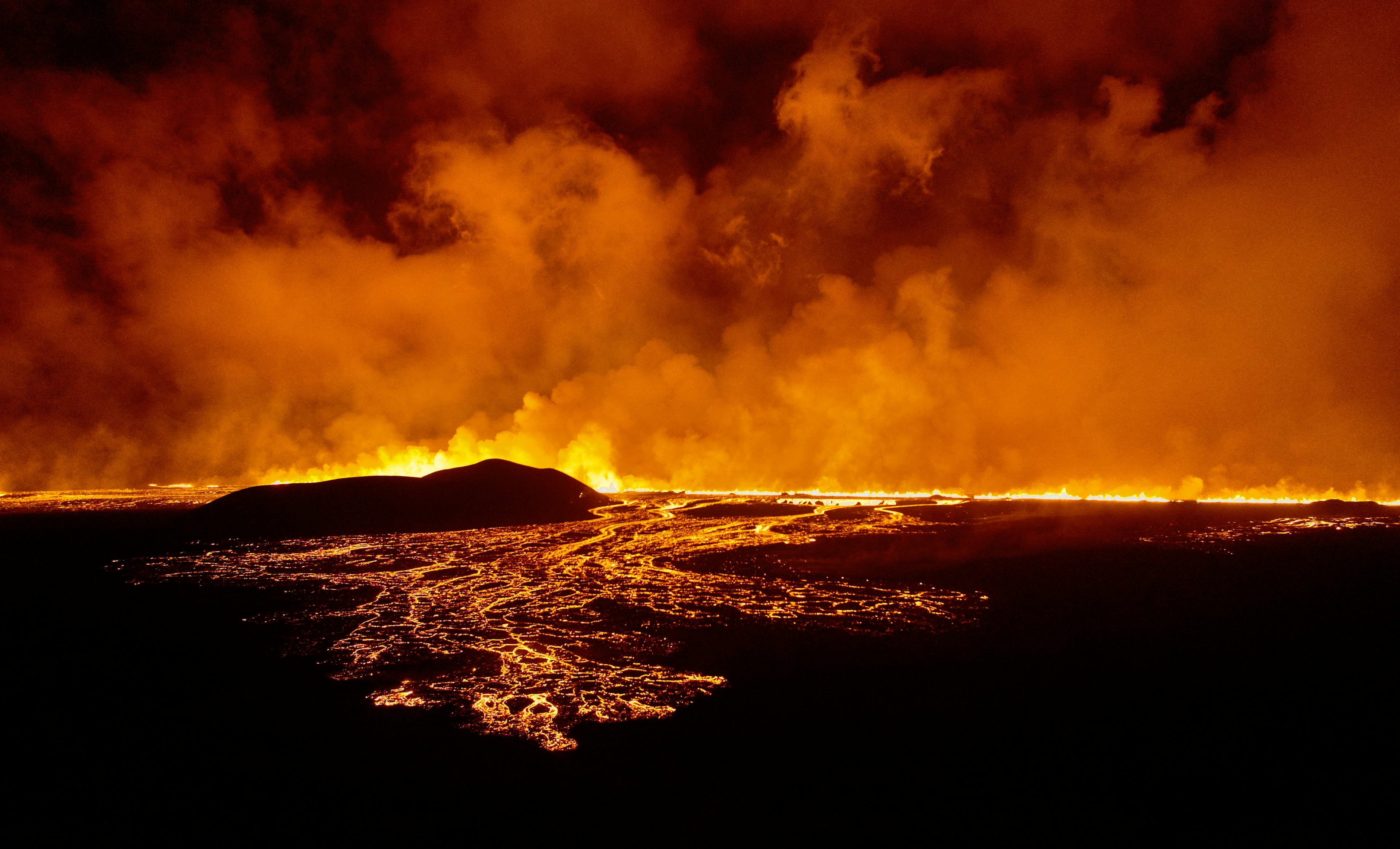
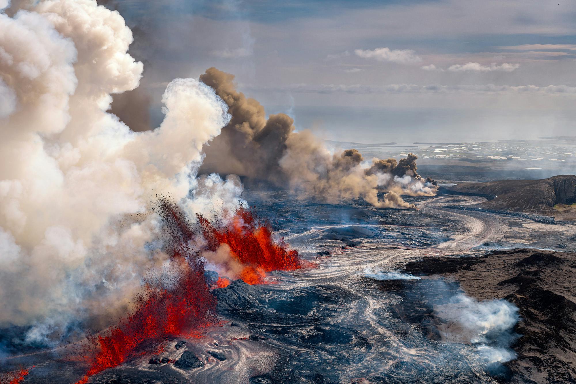
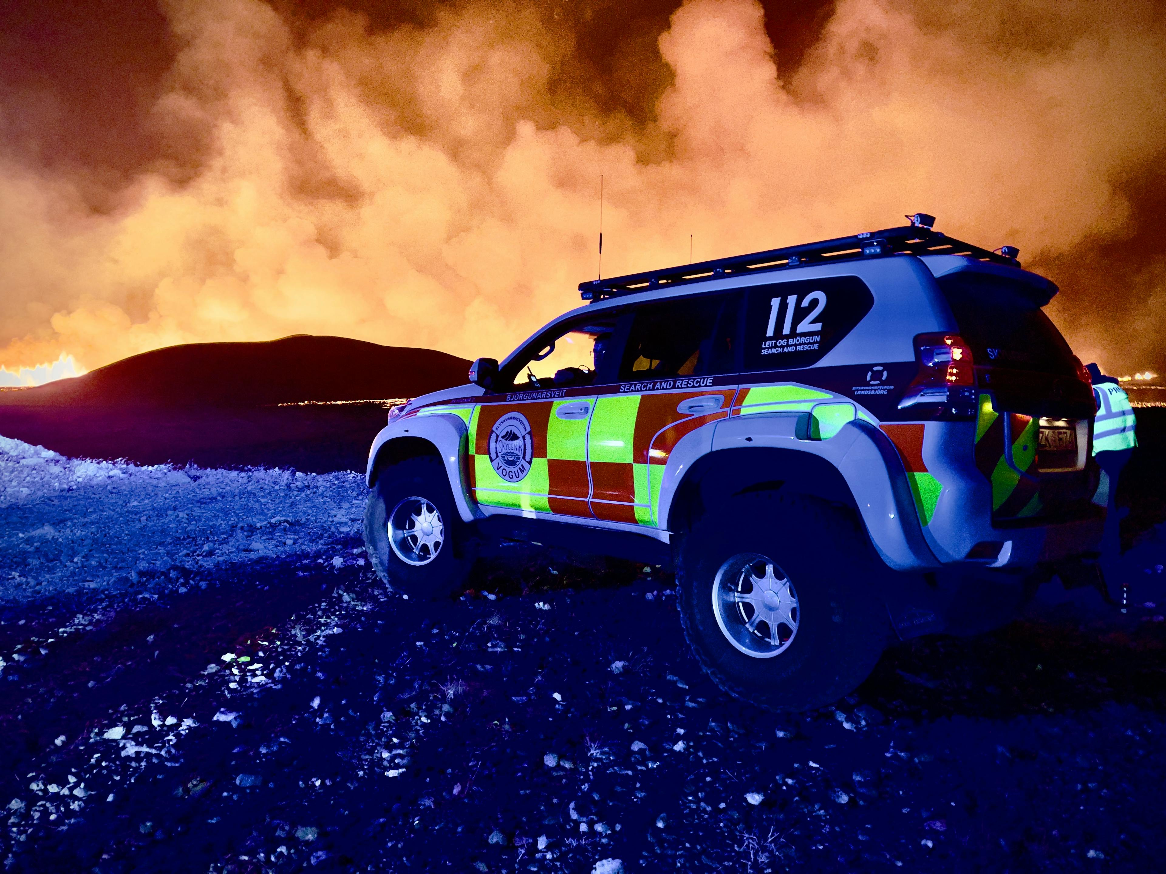
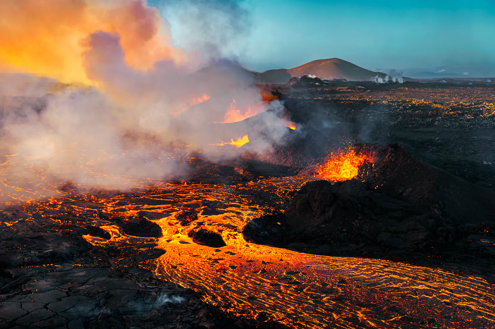
An eruption began on the 16th of July, 3:55 AM, along the Sundhnúkur crater row in southwest Iceland, with the fissure extending further north than previous eruptions in the area since December 2023.
Initially, activity was observed in up to ten craters, but it gradually decreased and became concentrated in fewer craters, with lava mainly flowing east and southeast toward Fagradalsfjall. No ashfall was reported during the eruption, but significant gas pollution and volcanic haze spread across large parts of Iceland.
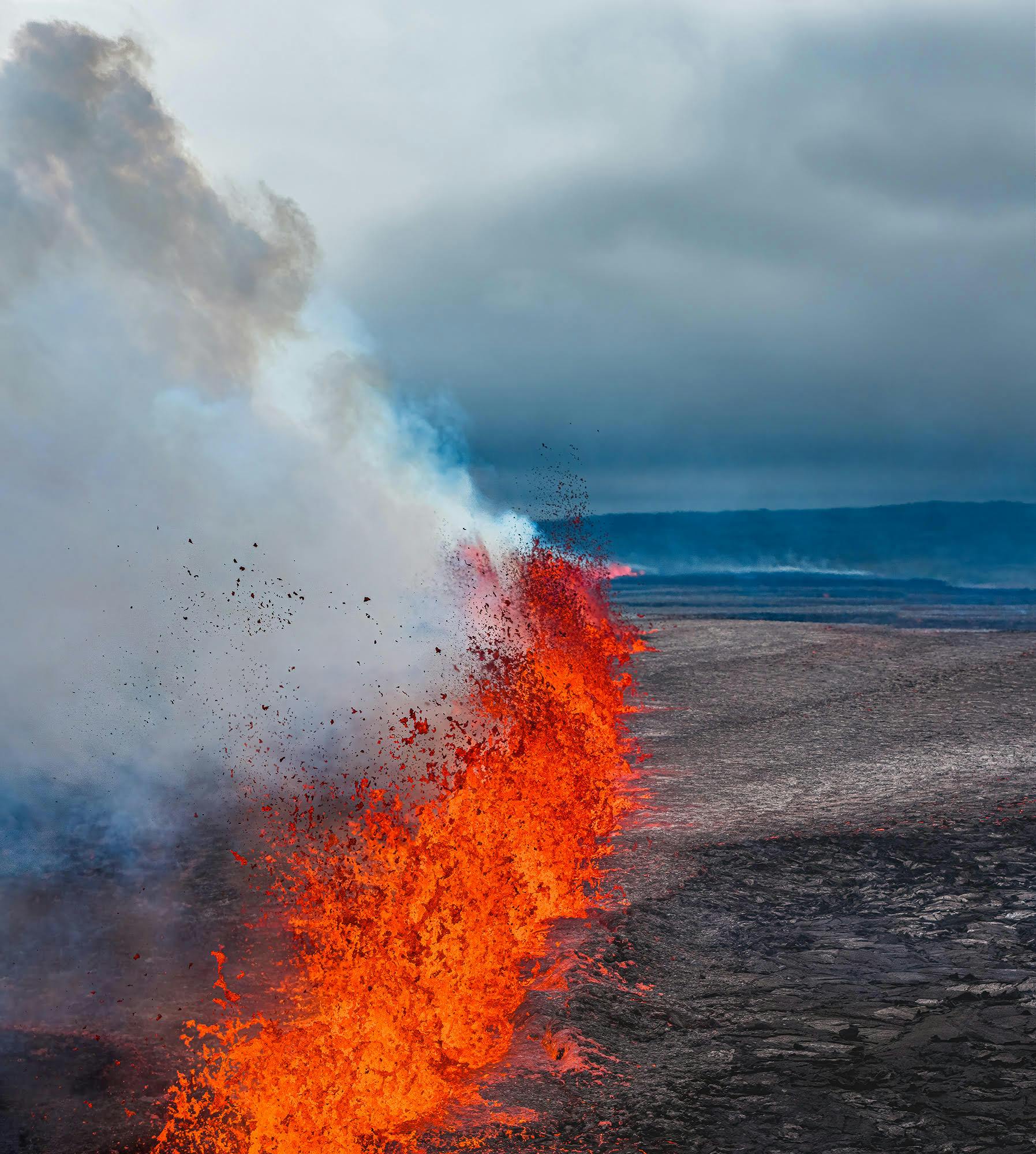
Throughout the eruption, the lava field steadily expanded. Measurements showed it reached an area of 3.3 km² and a volume of approximately 26.8 million cubic meters, with an average lava flow rate of about 12 m³/s at the eruption’s peak. Even as the lava flow diminished in the final days, the surface remained unstable and dangerous, with thin crusts that could collapse without warning, exposing molten lava beneath.
Following the eruption, renewed ground uplift has been detected beneath the Svartsengi area, indicating that magma is still accumulating underground. This suggests that further eruptions in the region remain possible.
Travelers are advised to show caution and check information for safety at Safetravel.is. Authorities are closely monitoring the situation. Flights are not disrupted, and it is safe to travel.
April Eruption 2025
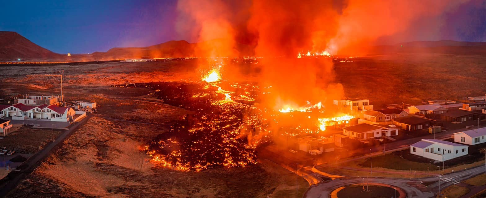
On April 1, 2025, an intense earthquake swarm began at 6:30 AM in the Sundhnúkagígar Crater Row, located between the Sýlingarfell and Stóra-Skógfell mountains on Iceland’s Reykjanes Peninsula. This seismic activity prompted the evacuation of the Blue Lagoon and the nearby town of Grindavík.
By 9:45 AM, a volcanic eruption commenced just north of Grindavík’s protective barriers, with the fissure expanding to approximately 500 meters by 10:00 AM and breaching the northern protective wall. This event marks the 11th volcanic eruption on the Reykjanes Peninsula since 2021 and the 9th within the Sundhnúkagígar system.
Despite the eruption’s proximity to populated areas, flights to and from Keflavík International Airport remain unaffected, and air travel continues as scheduled. Authorities are closely monitoring the situation, emphasising safety for residents and visitors. While the Grindavík and Fagradalsfjall areas are currently off-limits, other regions in Iceland, including Perlan in Reykjavík, remain open to visitors.
Read more details about the current eruption here!
November Eruption 2024
An eruption began between Stóra-Skógfell and Sýlingarfell at 11:14 PM on November 20, 2024. The activity appears to have peaked around 2:00 AM on November 21, after which the fissure stopped expanding. The eruption fissure is approximately 3 kilometres long, with lava flowing both eastward and westward.
Compared to the eruption that began on August 22, this event is significantly smaller. The current lava flow rate is estimated at 1,300 m³/s, which is nearly half the 2,500 m³/s observed during the August eruption.
One notable aspect of this eruption is the lack of significant seismic activity in the weeks leading up to the event, unlike previous eruptions. While the volume of magma beneath Svartsengi was comparable to that observed before the last eruption, there is a shift in trends. It now appears that larger volumes of magma are required to trigger eruptions, indicating potential changes in eruption patterns.
The westward lava flow has crossed Grindavíkurvegur and a hot water pipeline, continuing its advance. By midday (21.11), it reached the parking lot at the Blue Lagoon and shows no signs of stopping. Authorities are closely monitoring the situation as the lava progresses further westward.
A week later, the fissure remains active in three defined areas, with the central section being the most active. While the overall activity decreased over a period of time, it regained stability.This pattern suggests the eruption is not diminishing as quickly as previous eruptions in the Sundhnúkar crater row.
After a week, there is a single crater that is active. However, the eruption still demonstrates considerable power. The lava flow rate is comparable to the most intense eruptions at Fagradalsfjall, highlighting its sustained intensity despite some fluctuations in visible activity and seismic tremor. This is now the secound largest eruption at the Sundhnúkagígar Crater Row.
After nearly two weeks, the volcanic activity has been slowly declining. The lava flow is now confined to the existing lava field, showing little to no movement beyond its edges.
The last activity in the crater was recorded around 7:00 AM on December 8th, marking 18 days since the eruption began. This eruption is the largest of the seven that have occurred since December 2023.
It is important to note that this eruption is isolated and does not affect air travel or the rest of Iceland.
August Eruption 2024
The eruption started on the Sundhnúkagígar Crater Row at 21:26 on August 22nd, 2024.
At the beginning of the eruption, the fissure between Stóra-Skógfell and Sundhnúk opened, similar to the last volcanic eruptions. During the first few hours, the fissure continued to extend northeast from Stóra-Skógfell. As the eruption progressed northeastward, activity in the southern part diminished.
All measurements show that this eruption is the largest in the region since the earthworks began in the fall of 2023. There are measurements that have been made on the lava bed so far and model calculations that estimate the amount of magma that passed from Svartsengi into the Sundhnúkagígar Crater series when the eruption began.
On September 6th, the eruption was declared over as there was no visible activity in the craters. However, ground uplift has begun again in Svartsengi, indicating that magma is accumulating in the chamber once more. Monitoring will continue to assess the rate of magma buildup, which early models suggest is comparable to previous events.
May Eruption 2024
On May 29th, intense seismic activity on the Sundhnúkagígar Crater Row signalled the start of magma propagation, leading to a volcanic eruption at 12:46. Lava flowed over Grindavík and Nesvegur roads as the eruptive fissure extended to approximately 3.4 km, with an extrusion rate of 1,500-2,000 m³/s. The primary segment of the fissure measured around 2.4 km. Seismic activity decreased rapidly following the eruption, suggesting initial stabilisation.
This eruption started with 3 craters spewing lava but a week later one crater stood active. Even though there was one crater active, it continued to send out a steady stream of lava.
On June 22nd, 24 days later, the eruption was declared over. Despite no lava flowing from the crater now, land uplift in Svartsengi was detected again, indicating continued magma accumulation. The uplift has been steady since then but is now slower than it was between previous events
This eruption added to the Reykjanes Peninsula's volcanic history, highlighting the region's dynamic geological activity. The immediate response involved aerial surveys and satellite imaging to accurately map the extent of the lava flow and assess the eruption's impact on the surrounding areas.
March Eruption 2024
The March eruption on the Reykjanes Peninsula, initiated at 8:23 pm on Saturday, March 16th, marked the fourth significant volcanic event in the region since December. This eruption followed a brief period of tremors, with the Norwegian Meteorological Agency detecting a spike in seismic activity and landscape changes indicative of impending magma flow.
The emerging volcanic fissure, located between Stóra-Skógfell and Sýlingarfell, not only replicated the scenarios of the eruptions in February and December but also stretched over 3 kilometres, showcasing a remarkable and rapid release of lava.
This lava flow, directed westward across Grindavíkurvegur and then veering southeast along Grindavík's defences, signalled a threatening advance towards Suðurstrandarvegur in Reykjanes. In response to this potential threat, authorities were vigilantly enhancing the town's defences and safeguarding essential infrastructure to mitigate the impacts.
The volcanic activity remained stable for a week, showing its ability to maintain a steady intensity. This eruption distinguished itself by its length, surpassing the durations of the previous three eruptions since December 2023.
After a week, the eruption at Sundhnúksgíga subsided from its initial strength. This eruption distinguished itself by its length, surpassing the durations of the previous three eruptions since December 2023.
On May 9th, 2024, the eruption was declared over. However, the danger levels stay the same as there have been tremors in the area and land rise in Svartsengi. These indicate that there could be a new eruption at any minute.
It is important to note that the general public is not able to visit the eruption site at this time.
February Eruption 2024
An eruption commenced at 6:02 am on 8th February 2024, northeast of Sýlingarfell. This event marks the sixth volcanic eruption in five years on the Reykjanes Peninsula, and notably, the third eruption within a short span.
Around half an hour prior to the eruption, a series of earthquakes began within the magma intrusion located to the north of the town of Grindavík. Earlier in the morning, the Blue Lagoon was evacuated due to the seismic activity preceding the eruption, and no individuals were present in the town of Grindavík when the eruption started. The location mirrors the eruption that occurred on 18th December 2023.
The fissure stretched 3 km in length, and lava flowed both east and west but noticeably more to the east. By midday on 8th February lava had flowed over the hot water pipeline that extends from the geothermal power plant in Svartsengi to Njarðvíkur, resulting in supply issues in Reykjanes. The eruption has subsided significantly and there has been no visible activity since 8am on February 9th.
Fissure eruptions like this one, akin to all six occurrences on the Reykjanes Peninsula in recent years, do not disrupt flights to and from Iceland nor do they produce much ash. This stands in stark contrast to the events of 2010, when a distinctly different type of eruption occurred beneath glacial ice, resulting in significant ash production.
January Eruption 2024
An eruption just north of Grindavík, southeast of Hagafell, began at 7:57 AM on January 14, 2024. Making it the 5th eruption in the last four years.
Earthquakes began at the Sundhnúksgígar crater row in the early morning of January 14, with earthquakes moving to the town of Grindavík. Public safety was raised to an emergency level, and the small fishing town was evacuated.
The first fissure opened up around 900 metres from Grindavík. Unfortunately, the fissure opened up on both sides of a barrier wall that was built to protect the town from lava. Slowly lava flowed near the town. The good news is the remaining barrier wall directed most of the lava west, rather than south, towards Grindavík.
A new fissure opened at 12:10, 200 metres north of the town. Lava from this fissure entered the town only after flowing for an hour. The lava set fires and has covered at least three houses. 24 hours later, the flow from this smaller fissure has stopped.
See a complete overview of the Reykjanes Volcanoes here.
By January 16, the first, larger fissure showed no sign of ongoing eruption. However, movement continues to be measured in the southern part of the magma tunnel under Grindavík.
The eruption sites and surrounding areas are at high risk as new fissures can open without warning. That was the case when the fissure opened at the border of Grindavík on January 14; No spikes or signs were seen on the measuring instruments.
Although the eruption has ceased, GPS sensors detect ground deformation in and around Grindavík, showing that the underground magma channel under the town is making the ground expand. Thermal images revealed that cracks in the ground to the southwest of Grindavík have grown much larger. The area remains dangerous.
December Eruption 2023
After months of anticipation and earthquakes, a volcanic fissure emerged with a bang on December 18th, 2023. The eruption was located close to Sundhnúkagígar, about four kilometres northeast of Grindavík town. The force of this eruption is larger than the previous three in this area. It is estimated that the lava flow rate was in the hundreds of cubic metres per second in the first two hours. In the beginning, the lava was flowing outwards from both sides of the recently opened fissures.
The fissure, spanning about 4 kilometres, stretched from near Stóra-Skógfell in the north to near Sundhnúk in the south. It is nearly 3 kilometres from the southern tip to the outskirts of Grindavík.
The volcanic eruption soon lost its intensity on December 21, and scientists reported that there was no visible eruptive activity. However, hours later, there was still glowing lava in the channels.
During the eruption, the Communications Director of Public Safety, Hjördís Guðmundsdóttir, stated that this is not a tourist eruption and asks people not to try to go there. A translated quote from visir.is:
“There is a reason why we are asking people not to go there. This is a large eruption, and there is dangerous gas in the area. We are not playing Cry wolf; this is truly dangerous.”
Whether you’re planning a visit or just fascinated by geology, it’s worth checking which active volcanoes Iceland is monitoring closely this year.
Understand the Seismic Activity with Perlan
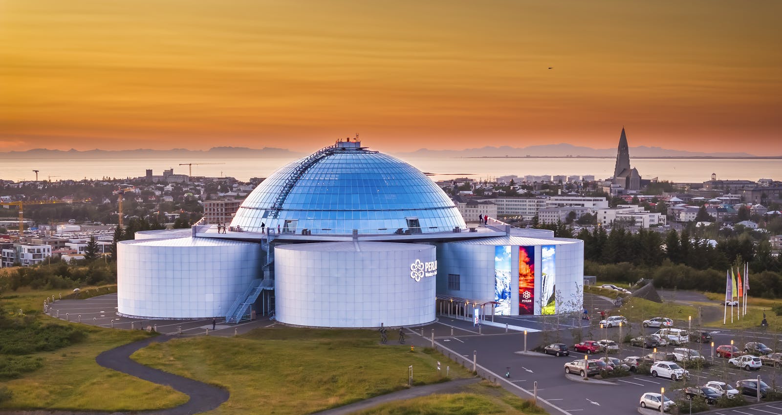
As Reykjanes simmers with volcanic activity, signalling a potential eruption, there's no better time to immerse yourself in the volcanic wonders of Iceland than now. Perlan stands as a premier destination for anyone fascinated by these natural phenomena. Our state-of-the-art volcano exhibition not only offers a rich educational experience but also provides an unrivalled, interactive journey through the fiery heart of Icelandic volcanology.
Visitors can witness the raw power of volcanic eruptions and understand the forces that shape our planet, all within the safety and comfort of Perlan's innovative facilities. With expert guides and stunning visual displays, Perlan is the perfect place to gain insight into the unfolding events at Reykjanes, making it a must-visit for locals and tourists alike who wish to experience the might of Iceland's volcanic landscape up close.
Leading Up to the Sundhnúksgígar Eruptions
Between October 25 and 30, 2023, Iceland's Reykjanes Peninsula experienced a surge in seismic activity, with thousands of earthquakes, some reaching magnitudes of 4.5, primarily around the Stóra-Skógfell area, indicating subterranean magma movements. This activity, attributed to the aftermath of a previous eruption at Fagradalsfjall, was accompanied by satellite-detected ground uplift, signalling rising magma pressure. By the end of October, the area had recorded around 1300 earthquakes, prompting close monitoring by experts due to the significant geological instability caused by various underground forces.
In the following week, from October 31 to November 6, 2023, Mount Þorbjörn saw an unprecedented seismic swarm of over 10,500 earthquakes, with a peak magnitude of 4.5, indicating deep magma movements about 4 kilometres underground. This activity, coupled with a 7 cm ground uplift at Mount Þorbjörn, suggested the presence of a magma-filled fissure, similar to events observed between 2020 and 2022. The seismic activity during this period varied, with notable spikes on November 2 and 4, yet all quakes remained below magnitude 3.0.
From November 7 to 14, increased earthquake activity, ground deformation, and sulfur dioxide emissions north of Grindavík highlighted the rising threat of magma intrusion close to the surface. The situation escalated around November 10-11, leading to the evacuation of Grindavík and the declaration of an emergency level of civil protection. GPS data later showed a deceleration in ground deformation, suggesting a possible ascent of magma towards the surface. Despite this, approximately 1000 earthquakes were recorded on November 12, mainly north of Grindavík.
By late November, seismic activity on the Reykjanes Peninsula began to wane, with a significant decrease in earthquake numbers by the end of the month. However, continuous uplift near Svartsengi suggested ongoing magma inflow, albeit with a reduced eruption risk in the Grindavík area due to the partial solidification of magma. Yet, the scenario remained dynamic, with a slight shift in activity by early December indicating possible new volcanic events. Despite a reduction in seismic activity and a slowing deformation rate, the situation remained precarious, with experts continuing to closely monitor magma movements up until the eruption on December 18, 2023.
Popular articles
Let's Talk About the Volcano in Iceland About to Erupt
Is a volcano in Iceland about to erupt? Here’s what travelers should know about Svartsengi, Reykjanes activity, flights, safety, and the Blue Lagoon.
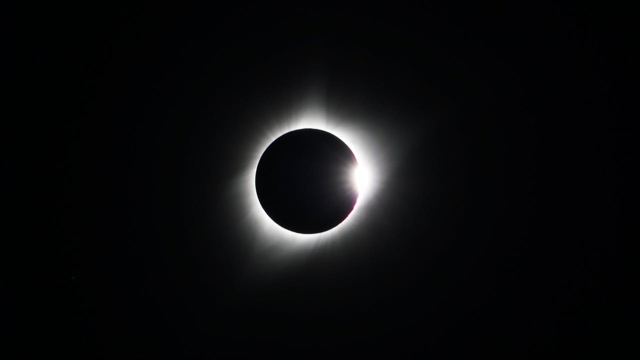
Guide to the Solar Eclipse 2026
Plan your trip to witness the Solar Eclipse 2026 in Iceland! Discover the best viewing spots, key times, safety tips, and travel advice for this rare celestial event.
Active Volcanoes in Iceland 2026
Active volcanoes aren't the same thing as active eruptions. A volcano can be considered active even when it is not ejecting ash, rock, gases and magma, so which are active in Iceland in 2026?

Top 10 Places To See the Northern Lights in Iceland
You can see the northern lights across the country, but some spots are more suitable than others. Find the best place to see the northern lights in Iceland.

Ice Caves From Reykjavik
Travel beyond the capital for a closer look at an ice cave under one of Iceland’s glaciers. If you can’t spare the time, experience Perlan’s ice cave in Reykjavik.