Guide to Mount Keilir
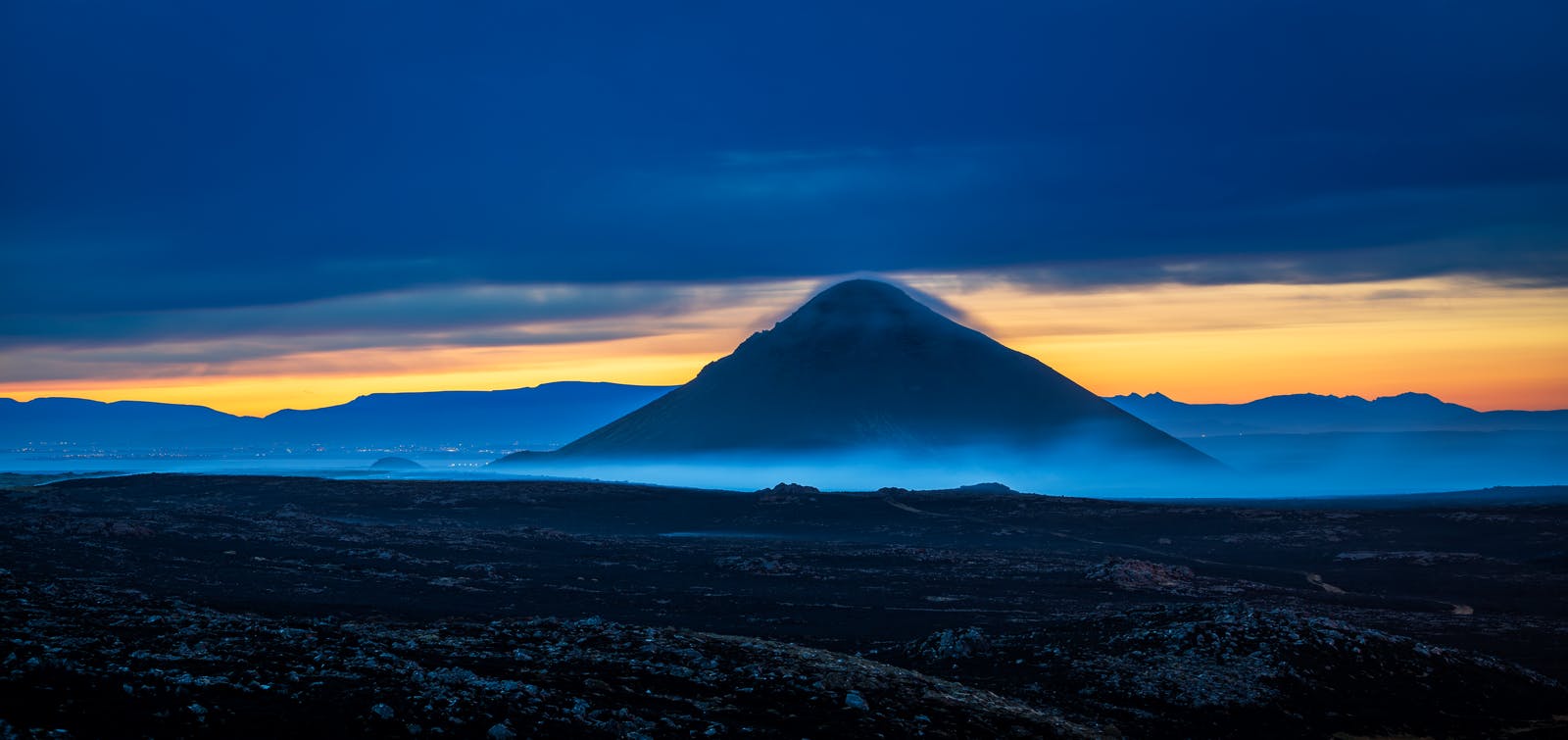
Keilir is a cone-shaped mountain on the Reykjanes Peninsula, 379 m high, that can be seen from the main road leading from Reykjavík to Keflavik International Airport. The mountain formed from sub-glacial eruptions during the Ice Age and is close to the most recent volcanic eruptions on Reykjanes.
What Type of Mountain is Keilir?
During the Ice Age, an eruption underneath a glacier formed Keilir mountain, pushing the earth metres into the air. Geologists class Keilir as a hyaloclastite mountain (a volcano formed under ice), although many scientists believe it actually to be a part of a large crater. The rock type hyaloclastite is formed by rapid cooling of basaltic magma during eruptions.
How to Get to Keilir
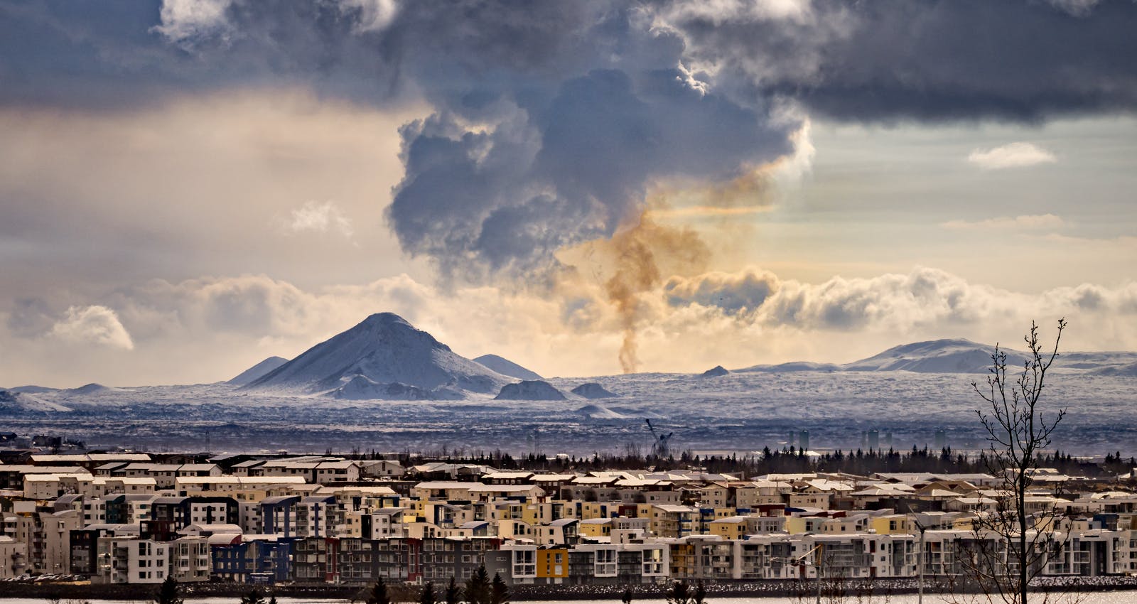
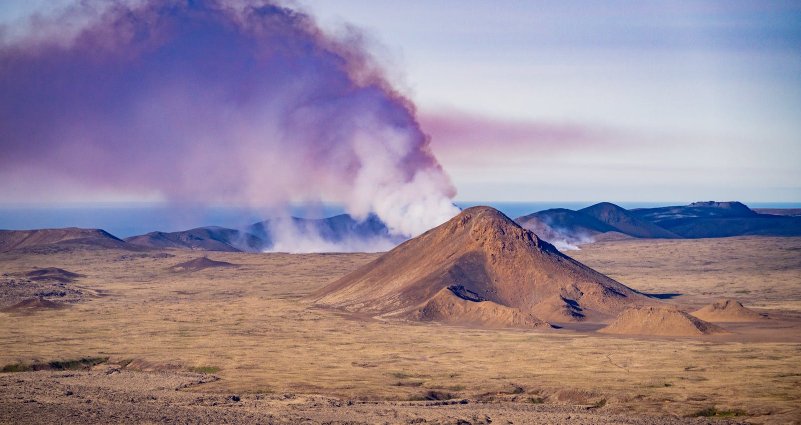
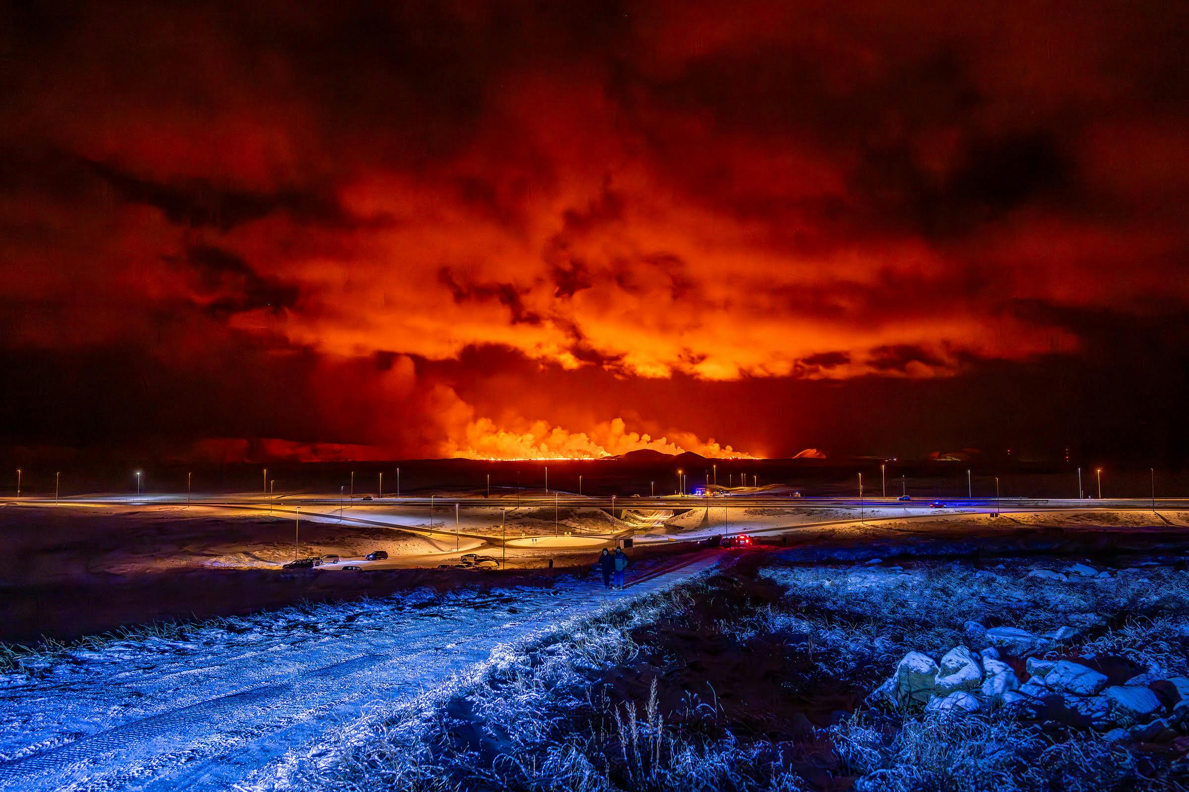
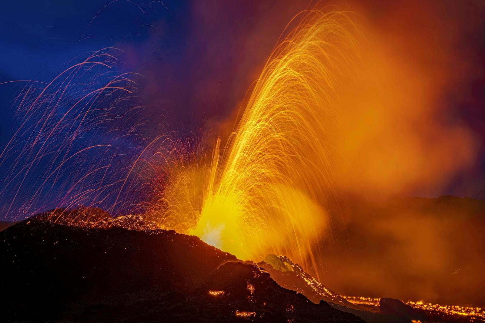
Driving from Reykjavik, it takes about 45 minutes to reach Keilir. The route is pretty direct as you drive towards Keflavik International Airport on Reykjanesbraut and follow the signs for Keilir. Keilir is close to the most recent eruptions from 2021-2023 on the Reykjanes Peninsula.
Can you Hike Keilir?
There are several beautiful, well-maintained hiking trails around Keilir, as well as trails leading to its top. Experienced hikers consider the level of difficulty of hiking up the mountain to be moderate since the slopes can get steep. However, the hike is rewarding since Keilir's peak offers a stunning view of the Reykjanes Peninsula and its sweeping lava fields.
The climb to the top takes approximately 2-3 hours, and you are rewarded with a beautiful panoramic view that takes your breath away. On top of the mountain, you will find a concrete table with a directional map etched into a metal table so you can identify various natural attractions that the mountain overlooks.
Safety Information
Before heading out on a hike, make sure you check the weather and road conditions and only proceed if conditions are favourable. The weather can change quickly in Iceland. Make sure you are dressed for the weather conditions, have sturdy footwear and have a charged mobile phone.
What Attractions are Close to Keilir?
Bridge Between the Continents
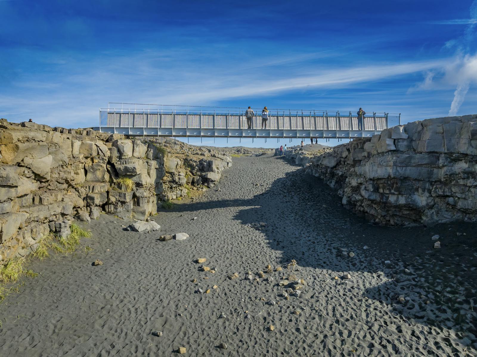
Travellers can visit a spot where the Mid-Atlantic Ridge crosses Iceland, the meeting point of the Eurasian and North American plates. The small footbridge is a symbolic site that connects the two land masses, and it offers visitors an impressive view of the ridge. You can reach the bridge from Route 425, a 20-minute (20-km/12-mi) drive south from Reykjanesbær.
Blue Lagoon
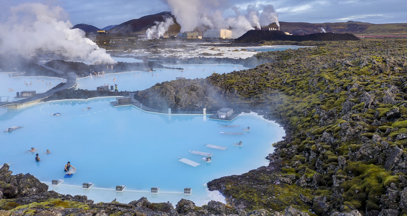
Built on an 800-year-old lava field, the Blue Lagoon covers an area of 8,700 square meters (93,646 sq ft) and draws visitors from around the world to soak in its gloriously milky-blue waters amid a dreamlike atmosphere. The geothermally heated water ranges between 37-39°C and is heavenly any time of year.
Enjoying the steamy air while soaking during the summer is lovely, especially on sunny days. In the winter, a visit here is eerie and wonderful; watching as snow falls from the jet-black December sky or as northern lights dance across it while lounging in hot water is sublime.
Learn About Volcanoes and Mountains in Iceland?
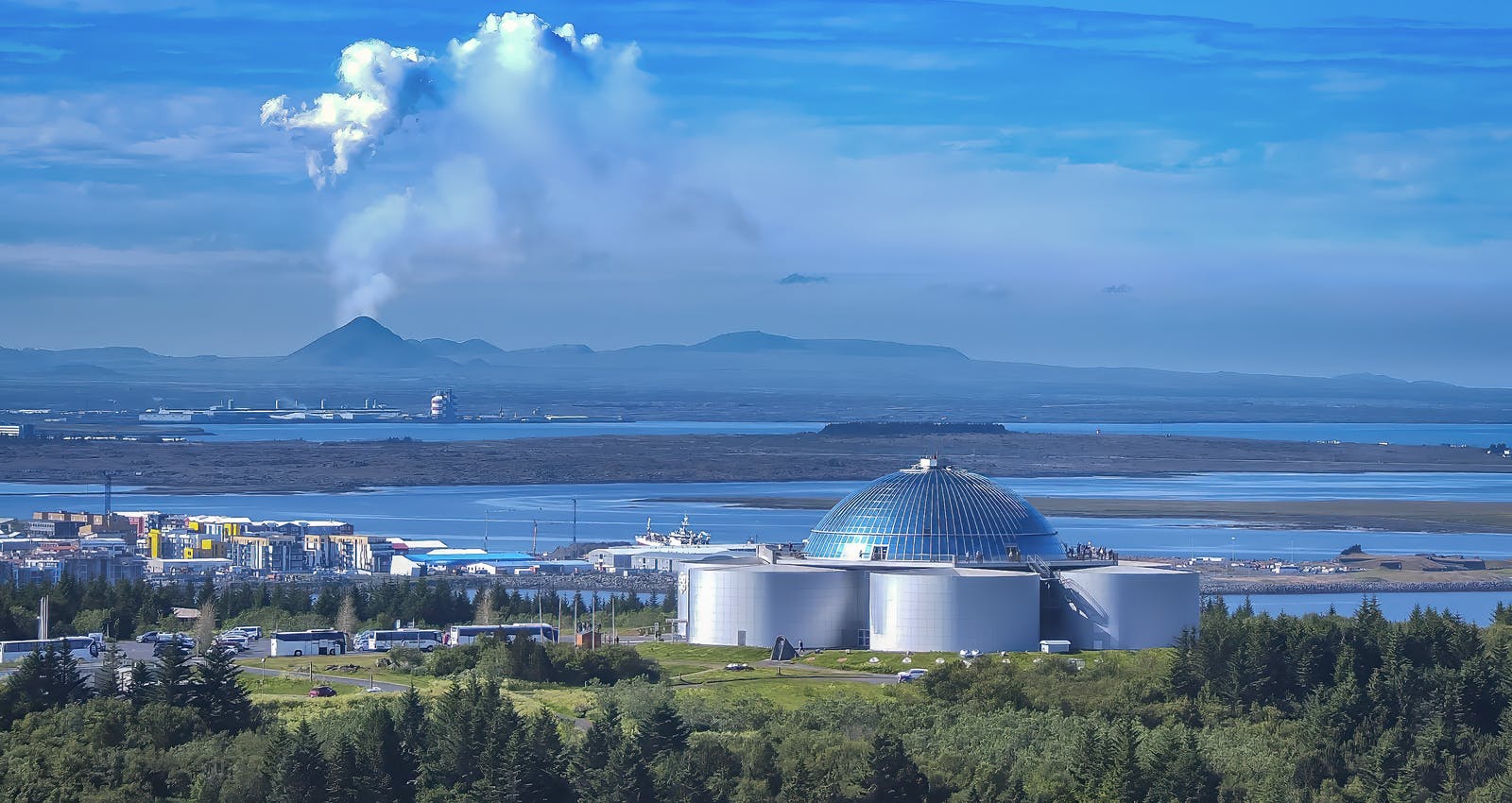
Perlan's Forces of Nature exhibition allows guests to feel the power of volcanoes, earthquakes, and geothermal energy that powers the island. Guests will learn that volcanoes form when heat and pressure build up beneath the earth's surface. The earth's weak points tend to be along fault lines where tectonic plates converge or diverge, as in Iceland's case.
Perlan's exhibition shows that volcanic activity in Iceland is so diverse that researchers typically speak of "volcanic systems" rather than individual volcanoes. The island has 30 active volcanic systems, each with many types of volcanoes. Perlan also has exhibitions featuring ice caves, northern lights and geology.
Popular articles
Reykjanes Volcanoes Overview
Enjoy a complete overview of the Reykjanes Volcanoes from 2021-2024. Learn about its geology, recent activity, and visitor tips for a safe, memorable experience.

Reykjanes Peninsula Volcanoes: Sundhnúksgígar Eruptions
The anticipated volcano has erupted in the Reykjanes Peninsula, the site is being called Sundhnúkagígar. See the historic insights on the seismic activity and volcanic eruptions.
Earthquakes in Iceland
Earthquakes in Iceland are a fact of life. Each year, hundreds of small tremors shake the earth, a reminder of the country’s position on a tectonic plate boundary.
Volcano Museums and Exhibitions in Iceland
If you don't manage to visit an actively erupting volcano in Iceland - Experience its force at one of these excellent volcano museums and exhibitions in Iceland.

Top 10 Places To See the Northern Lights in Iceland
You can see the northern lights across the country, but some spots are more suitable than others. Find the best place to see the northern lights in Iceland.

Ice Caves From Reykjavik
Travel beyond the capital for a closer look at an ice cave under one of Iceland’s glaciers. If you can’t spare the time, experience Perlan’s ice cave in Reykjavik.