Guide to Hveradalir Geothermal Area
Iceland, a land formed by powerful natural forces, hosts unique geological sites. Among these, Hveradalir geothermal area stands out as a prime example of the island's raw, untamed geological power.
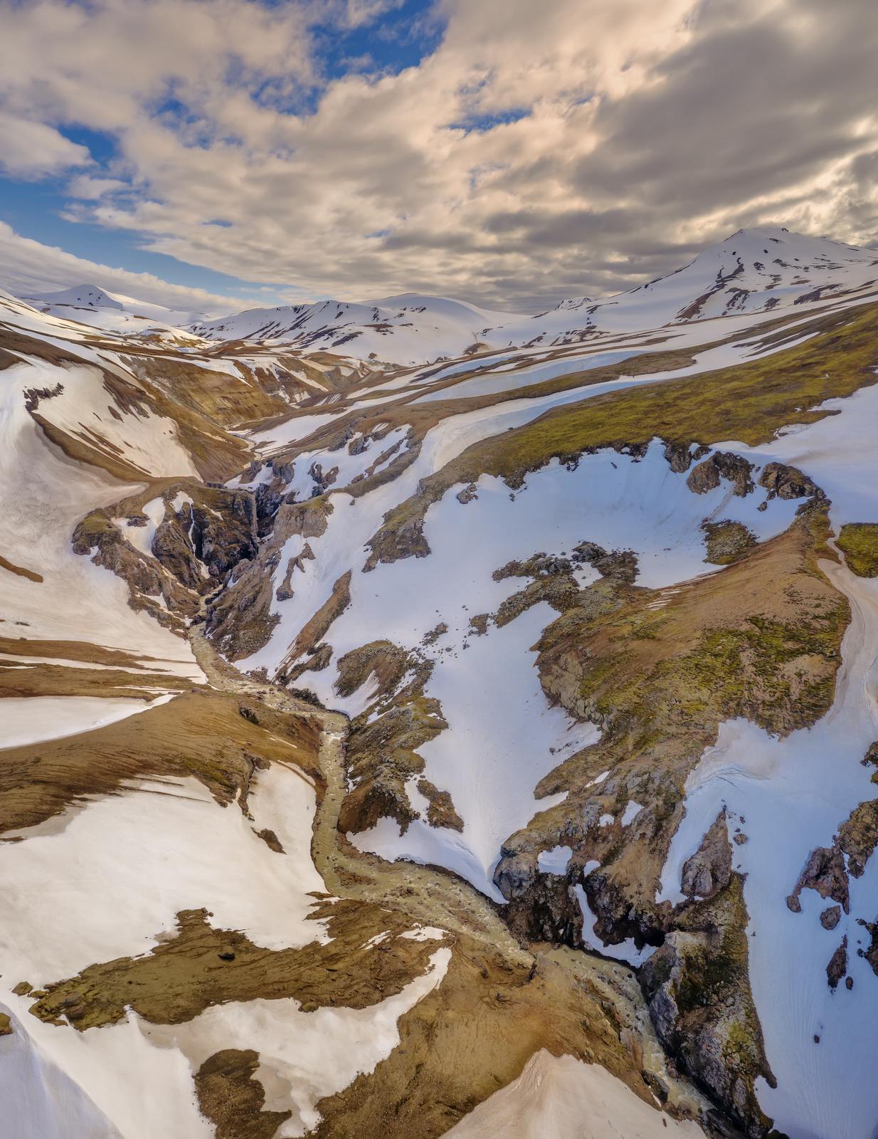
Tucked deep in Iceland’s central highlands, the valley features steam rising dramatically from the ground, rich minerals coloring the hillsides in vivid hues, and mud bubbling with a mesmerizing rhythm in steaming hot pools.
This remarkable landscape is shaped by constant heat from deep underground, creating an environment unlike many others on Earth. It's a place where the Earth's internal energy is overtly visible, a constant reminder of the planet's dynamic nature.
The Landscape of the Icelandic Highlands
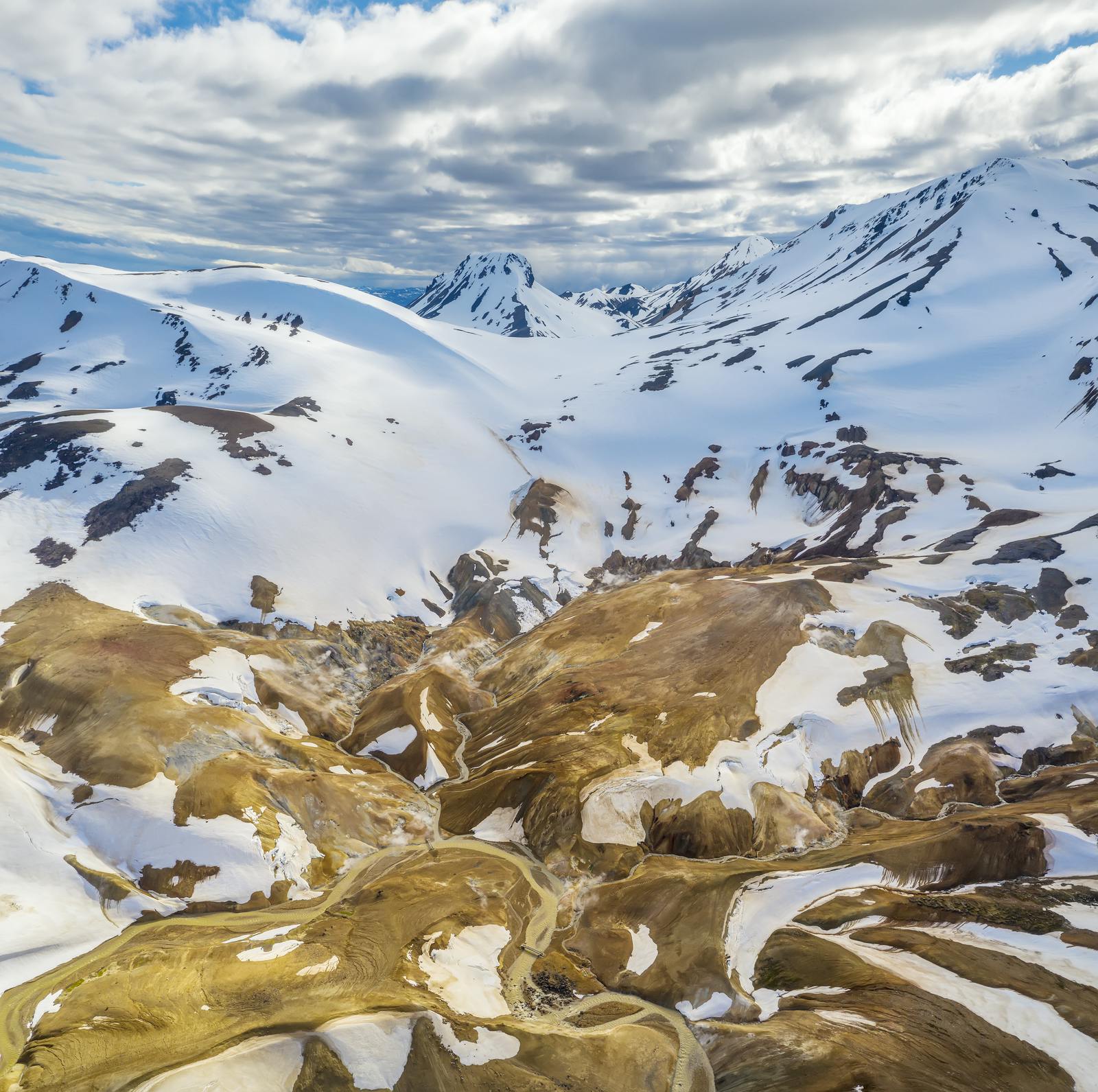
The Icelandic highland is a vast, open region lying above the tree line. Here, vegetation is sparse, giving way to expansive lava fields, stark glaciated mountains, and barren volcanic deserts.
The terrain is often rugged, characterized by volcanic rock formations, black sand expanses, and occasional patches of hardy moss. Yet, within this seemingly desolate expanse, geothermal heat creates small pockets of warm soil where resilient moss and algae survive, adding subtle splashes of green to the otherwise stark landscape.
The highlands are fundamentally shaped by immense volcanic and geothermal forces, setting them apart dramatically from Iceland’s more verdant coastal regions. Hveradalir demonstrates how heat and water interact beneath the surface, transforming seemingly inert rock with colorful minerals and rising steam. It's a living laboratory of geological processes.
Heat and Minerals in Motion
Hveradalir means “valley of hot springs” in Icelandic, a fitting name for this intensely active area. It lies within the Kerlingarfjöll mountain range, a geologically active zone located in the highlands.
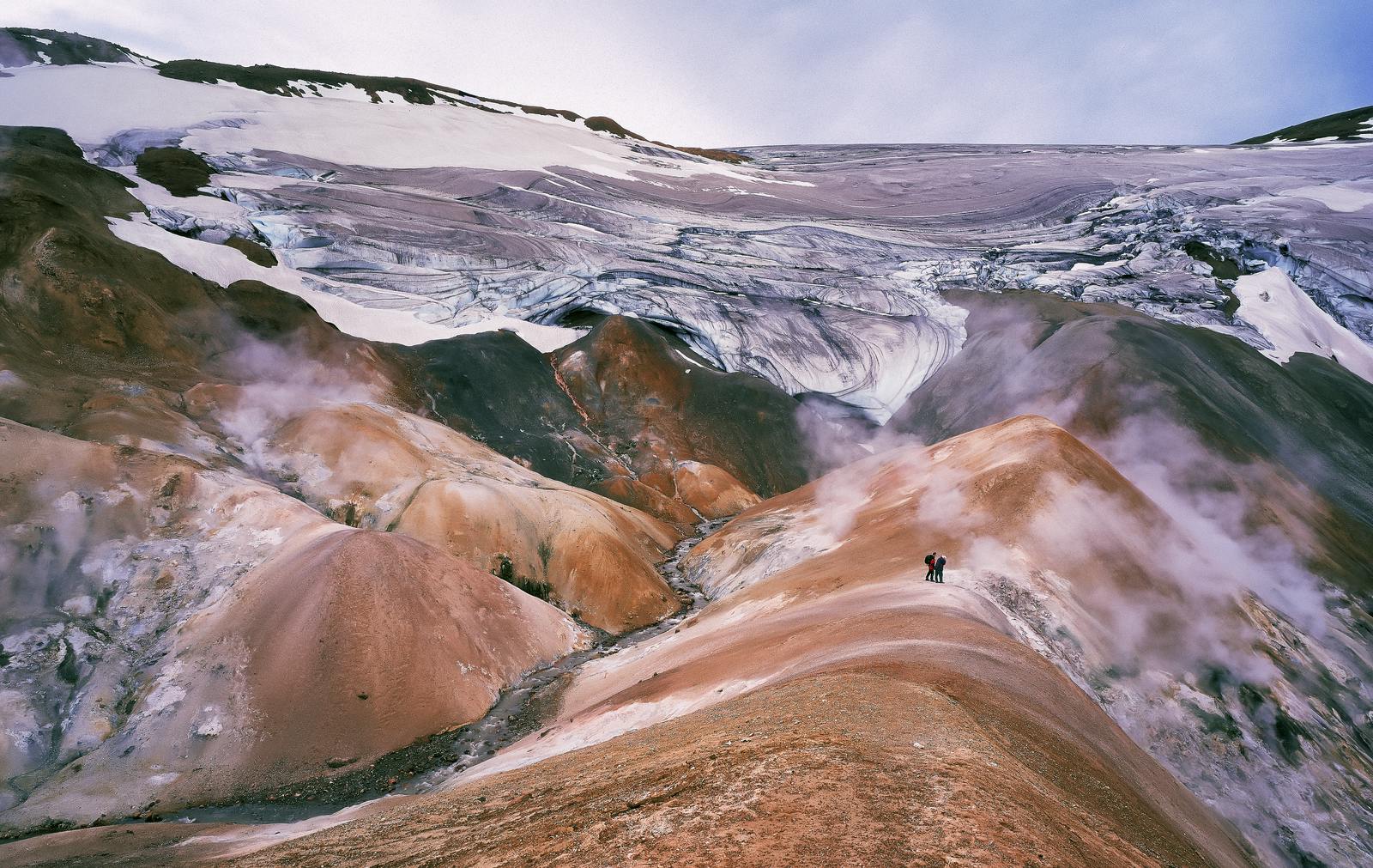
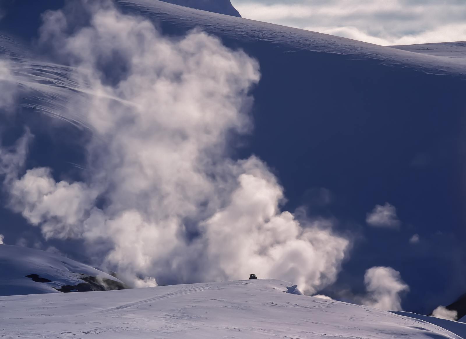
The landscape here is dramatically marked by numerous steam vents, known as fumaroles, and shallow, intensely mineral-rich pools. These features unequivocally reveal the fierce underground heat that defines the area.
Within this raw environment, water heated well beyond 100°C (212°F) surges to the surface, manifesting as vigorously bubbling mud pots and hissing steam fissures. The mud pots are particularly captivating, formed when underground superheated water interacts with surface minerals and clay, creating thick, gurgling puddles that can reach boiling temperatures.
The constant heat drives chemical reactions, causing minerals like iron, sulfur, and silica to leach out and dramatically stain the terrain. This process creates the striking hues of red, yellow, and white that paint the hillsides, transforming the very geology of the area into a visible, dynamic artwork, changing with the light and atmospheric conditions.
Visitors can truly witness geology in action, a testament to the planet’s internal forces at play.
Geothermal Activity and Its Role in Iceland’s Nature
Iceland's very existence is a direct consequence of its unique geological position on the Mid-Atlantic Ridge, a colossal underwater mountain range where the North American and Eurasian tectonic plates slowly pull apart.
This constant tectonic movement creates fissures in the Earth’s crust, allowing magma to rise close to the surface, resulting in pervasive volcanic and geothermal activity across the island. Hveradalir is one of several high-temperature geothermal areas where this intense heat escapes directly through cracks and vents in the earth.
This abundant geothermal energy not only sculpts the dramatic landscape, forming unique features like hot springs and mud pots but also supports unique ecosystems adapted to the warm soils.
Despite the seemingly harsh and barren appearance of the surrounding highlands, specific extremophile microorganisms, as well as various mosses and algae, thrive in these unique warm pockets. They create isolated patches of vibrant life against the stark backdrop, providing scientists with valuable insights into adaptation in extreme environments. The interaction between heat and life here is a fascinating aspect of Iceland's natural heritage.
Hveradalir in Iceland’s Geothermal Network
Unlike many of Iceland’s more accessible geothermal sites, which are often located closer to population centers or the Ring Road, Hveradalir’s remote setting in the central highlands helps preserve its largely untouched, pristine character.
This seclusion ensures a more authentic and immersive experience for those who make the journey. It lies near the Kerlingarfjöll mountain resort, which serves as a crucial highland base for visitors, providing essential services such as accommodation, dining, and organized tours, as well as controlled access points to the geothermal zone.
The valley is an integral part of a vast, interconnected system of volcanic heat that profoundly influences Iceland’s landscape, its climate, and critically, its national energy strategy.
While similar geothermal sources across the island are extensively developed for energy, contributing to heating over 90% of Icelandic homes and providing a significant portion of its electricity, Hveradalir itself remains primarily a natural marvel. Its preserved state allows visitors to witness the raw geological forces shaping the island without the interference of large-scale infrastructure. Think of it as a direct connection to Iceland's volcanic heart.
Natural Wonder and Sustainable Power
Geothermal areas like Hveradalir have been deeply woven into Icelandic culture for centuries. Historically, locals would seek out natural hot springs for bathing, warmth, and even cooking, utilizing the direct gifts of the land. This practice continues in various forms today, reflecting a deep respect for and reliance on natural resources.
In the modern era, Iceland has become a global leader in harnessing this immense geothermal power on a large scale for both district heating and electricity production, pioneering sustainable energy solutions that are now admired worldwide.
While other geothermal fields are extensively developed for energy, Hveradalir remains mostly in its natural state. It serves as a powerful, living reminder of Iceland’s dynamic volcanic past and its ongoing geological evolution.
Its remote location highlights the raw, untamed geological forces that continue to shape the island. Nearby, Kerlingarfjöll resort offers a safe way to explore this wild terrain in a safe and controlled way, balancing accessibility with preservation. This approach encourages both awe and respect and helps people understand nature’s role in sustainable energy.
How to Get to Hveradalir
Visiting Hveradalir requires planning due to its remote, rugged terrain. The journey itself is an integral part of the highland experience, offering views of vast, untouched landscapes.
Vehicle Requirements
Access roads to the central highlands are primarily gravel roads, designated as F-roads. These are unpaved, often rough, and can feature loose gravel, potholes, and corrugations.
A 4x4 vehicle rental is not just recommended but legally required for driving on F-roads. Attempting these roads in a standard two-wheel drive vehicle can result in significant damage and invalidate your insurance. It's crucial to ensure your car rental agreement permits F-road travel.
Parking and Access
A designated parking area is conveniently located near the geothermal zone, providing a safe place to leave your vehicle before beginning your exploration on foot. From the highland base of the Kerlingarfjöll mountain resort, there are well-defined routes that lead to the valley.
Marked Trails
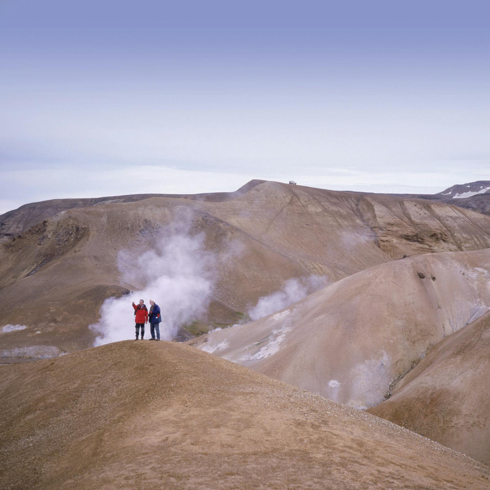
Once you arrive, a network of marked trails guides visitors safely around the sensitive hot springs and bubbling mud pools. It is crucial to stay on these marked trails at all times. The ground surrounding geothermal features can be deceptively thin and dangerously hot, posing severe burn risks. Respecting the marked boundaries protects both visitors and the fragile environment. Many visitors enjoy walking a specific hiking trail that offers panoramic views of the geothermal area.
River Crossings
Some routes or approaches to Hveradalir, especially if you are venturing further on a hiking trail in the wider Kerlingarfjöll area, may involve unbridged river crossings.
These can be hazardous, particularly after heavy rain or during periods of significant glacier melt. Always check water levels and conditions beforehand, and exercise extreme caution. Never attempt a crossing if you are unsure of the depth or current.
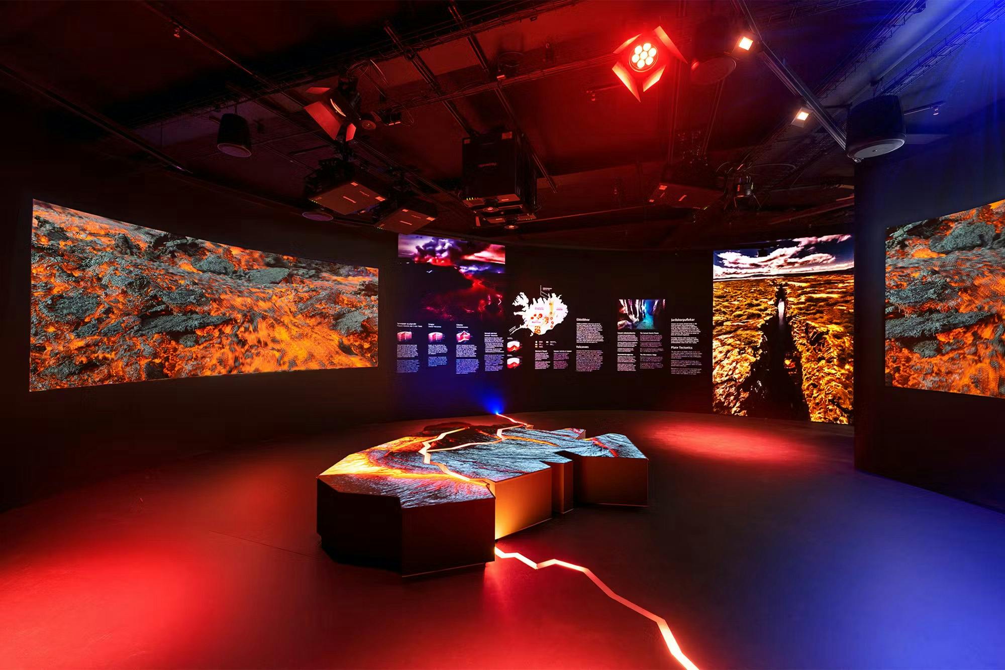
Learn More at Perlan
If you want to understand the science behind Iceland’s landscapes, Perlan in Reykjavik offers engaging and immersive exhibits. Through interactive displays, you can explore the intricacies of volcanic activity, understand the formation of hot springs and bubbling mud pools, and learn how areas like Hveradalir connect to the wider geology of the region. Perlan provides a fantastic opportunity to contextualize your highland adventure with scientific insight.
Frequently Asked Questions About Hveradalir
Can you swim in the hot springs at Hveradalir?
No, the springs are too hot and unsafe for bathing. Always respect safety warnings and stay on marked trails.
What causes the mud to bubble in Hveradalir?
The heat from underground boils water trapped in the soil, causing mud and gases to bubble to the surface.
Where is Hveradalir located?
It’s situated in Iceland’s central highlands near the Kerlingarfjöll mountain resort.
What colors are found in Hveradalir’s landscape?
The landscape is vividly colored by red, yellow, and white minerals staining the soil and rocks.
Is there any plant life near Hveradalir?
Yes, some specialized mosses and algae manage to grow near the warm soils around the springs, adapted to the unique conditions.
Why does the air smell in Hveradalir?
The distinctive smell is primarily due to hydrogen sulfide gases, a common emission from volcanic activity.
How does Hveradalir fit into Iceland’s geology?
It is a prime example of an active high-temperature geothermal area where volcanic heat escapes directly through the Earth’s crust, highlighting Iceland’s position on a divergent plate boundary.