Exploring Iceland’s Unique Flat-Topped Mountains
Why Are Iceland's Mountains Flat-Topped?
Wherever you step outside in Reykjavík, you will find yourself surrounded by flat-topped mountain ranges. The story as to why Iceland's mountains do not have the typical high-reaching peaks lies in its glaciation history. Find out all about the formation of the Icelandic 'Stapi' and the unique interaction between volcanoes and ice that lie at the base of the formation of Iceland's flat-topped skyline in the article below.
Formation History
During the Pleistocene epoch, the global climate was colder than it is nowadays. Periods of long-term glaciation and cold, dry climates alternated with shorter, slightly warmer, and less arid periods. During the glaciated periods, the entire surface of Iceland could get covered by a large ice sheet. The last of these so-called 'Ice Ages' took place about 115.000 to 11.700 years ago.
During the cold periods, the ice cover wasn't equally thick everywhere. It is believed that at times in the Westfjords, no rock surfaced through the thick ice anymore, while in the East, some peaks still poked through the surface of the ice. Where the mountains were covered by ice, glaciers scourged out deep valleys and steep, narrow fjords.
Difference of the East and the West
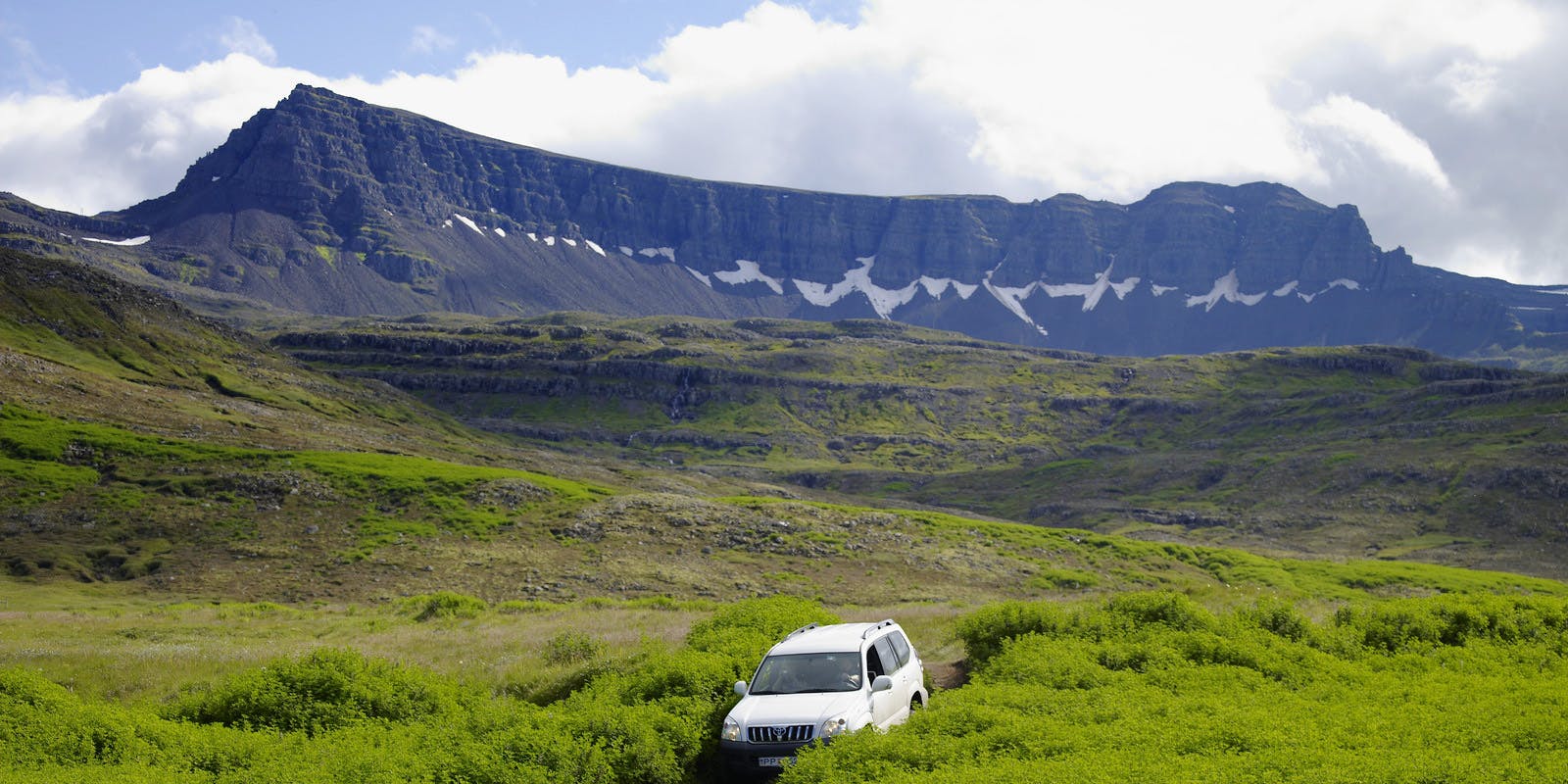
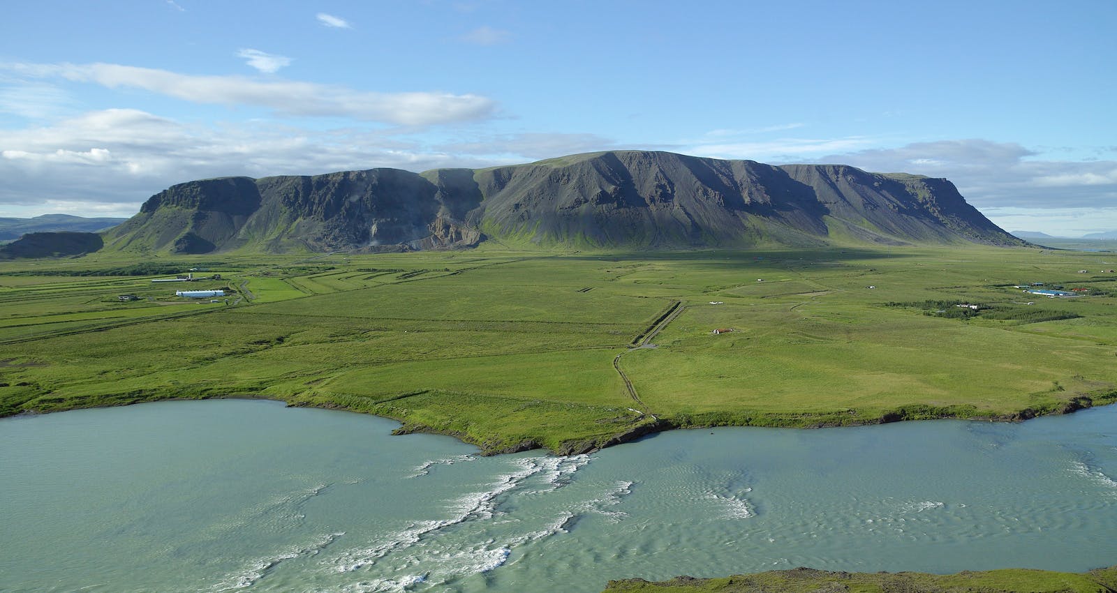
In the East, the peaks of several mountains have never experienced the long-term effects of glacial erosion; hence, they are still standing tall, pointing sharply up into the air. In the West, the load and movement of the glaciers pressing on the mountains polished any spikes and peaks back to gentle bumps. Now, only a slightly sloping, bumpy landscape remains directly bordered by steep vertical cliffs that meet the ocean at their feet. Glacial erosion is the first and foremost reason for Iceland's flat-topped skyline.
Subglacial Volcanism
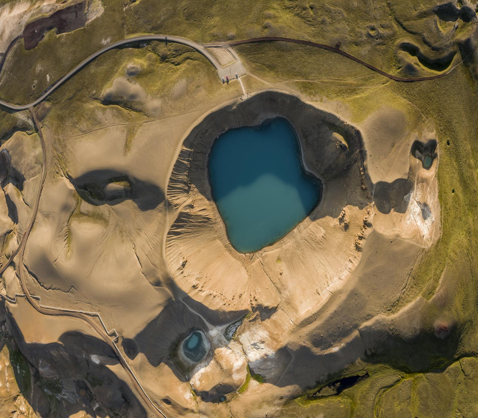
Apart from glacial erosion, there is another major mechanism that helped shape the broad flattened mountain ranges. Subglacial volcanism results in landforms quite different from the typical volcanic scenery. This might be best explained by investigating some of the distinct table-topped mountains that stand isolated in the Icelandic landscape.
These are the 'Stapi' or Tuya's. These table mountains have not just been weathered and shaped by the glaciers after their formation; they have been formed from underneath the ice, giving them their distinct flat-topped shape from the very beginning.
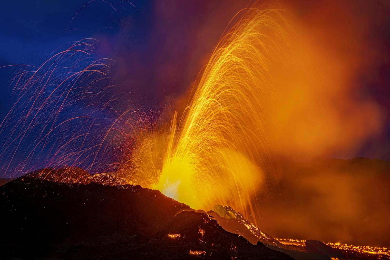
During the Ice Age, almost the entire surface of Iceland was covered by an ice sheet several hundred metres thick, but this didn't stop the volcanoes underneath from erupting. The only difference is that the lava was confined within the ice and formed different, often much more durable rock types in contact with liquid water.
While eruptions were ongoing, the ice slowly melted as the volcano kept expelling its hot material. In case of long-lasting events, the eruption could eventually break through the surface of the ice sheet.
Once the lava breaks through the ice, it spreads out to form a strong cap rock on top of the new hyaloclastite formation. It can even start forming regular subaerial volcanic structures like a crater. The strong lava cap protects the hyaloclastite rock underneath from erosion. As the last glaciation came to an end, the ice melted away, and the isolated flat-topped mountains known as Tuya's, or in Icelandic' Stapi', stayed behind.
Where to Find the Most Impressive Stapi in Iceland
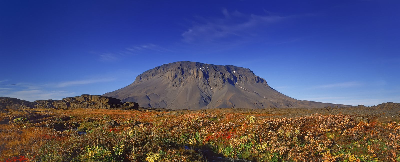
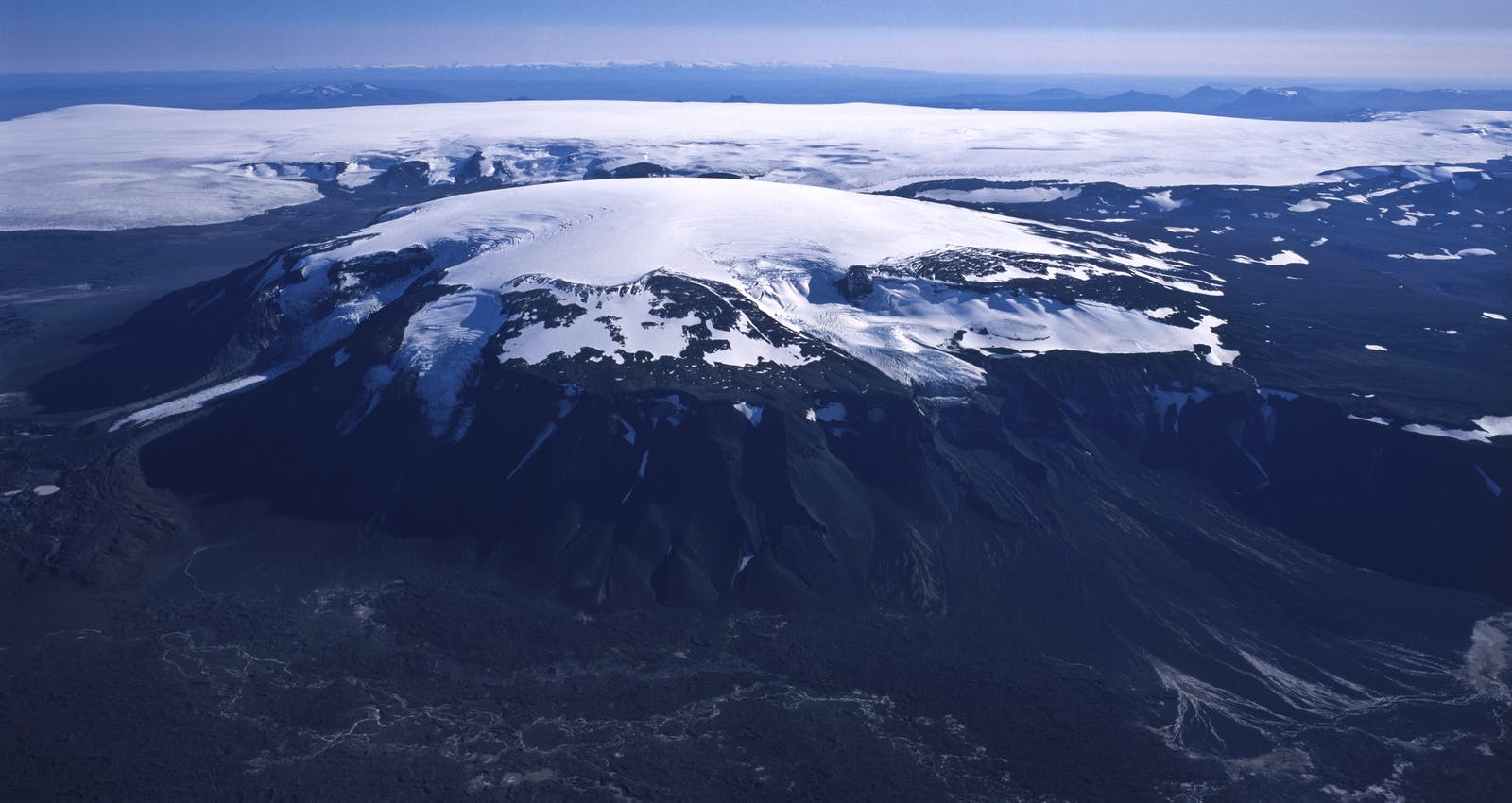
In the northeast, near the famous Askja volcano, lies Herðubreið, the prototype of the Icelandic Table Mountains. It was formed during the last glaciation period (~100.000-10.000 y.a.) by multiple eruptions taking place under an Icecap with a thickness of at least 1500m.
It is by some considered the national mountain of Iceland and well known by its nickname 'The Queen of Icelandic Mountains'. Though no one knows exactly how she gathered this title, the sharp edges along the steep circular table-top might give you an impression. A little to the southeast, a volcanic crater produced during her last eruption stands on top of the flat table-top area, completing the resemblance to a queen wearing her crown.
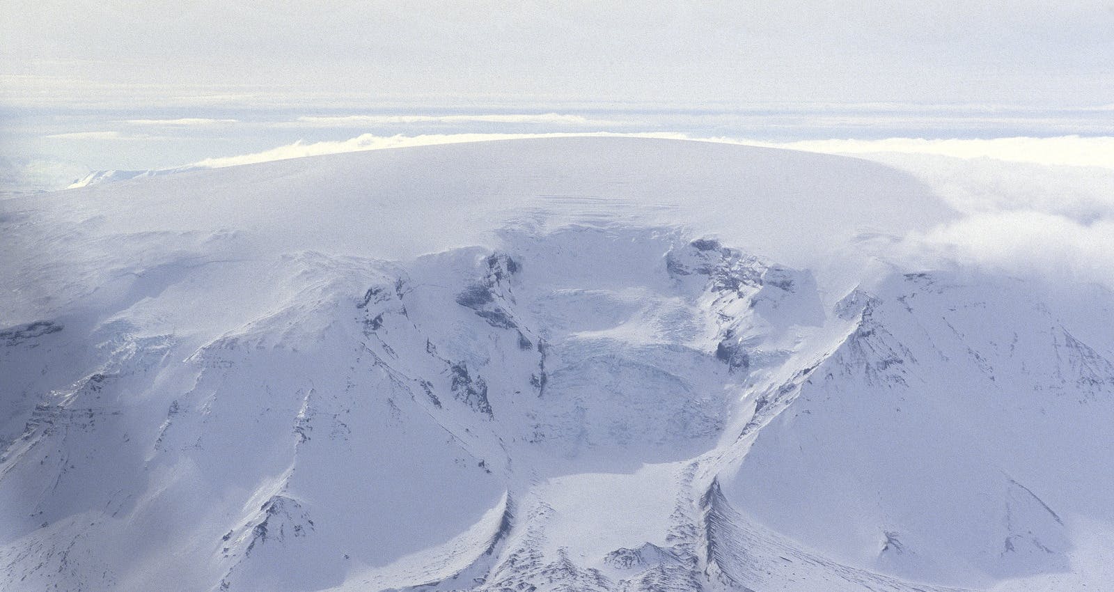
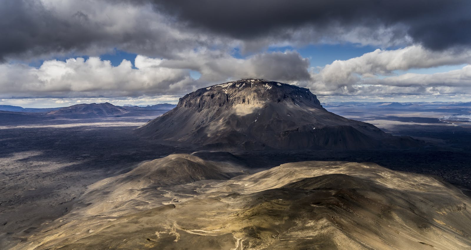
Kistufell
Kistufell is one of the most prominent table mountains in Iceland. It is located north-northeast of Bárðarbunga volcano on the northwest margin of the Vatnajökull ice cap. The exact age of Kistufell is unknown, but since it is relatively small compared to, for example, Herðubreið, it is believed it has likely formed under a thinner layer of ice. This suggests its formation must have taken place towards the end of the last glaciation when much of the original ice sheet had already melted away. Wind erosion has further shaped the layered structure of the mountain, polishing the strong lavas while scoring out the softer layers in between. Its narrow shape, steep sides, isolated position and jagged peaks on top make Kistufell an unforgettable and impressive sight.
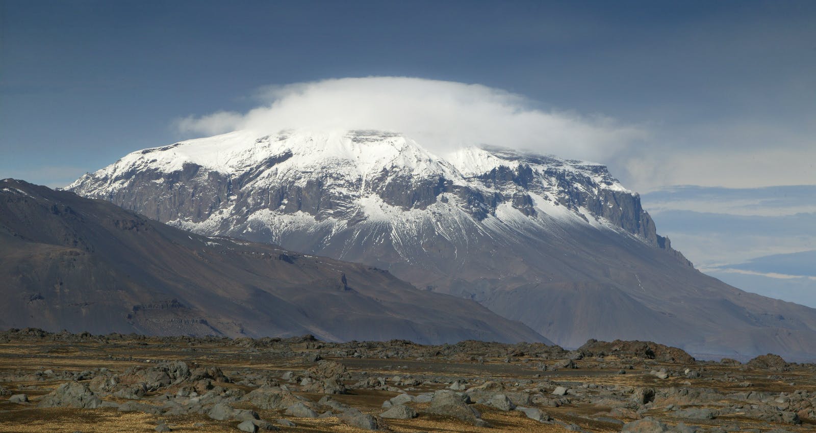
Eiríksjökull
In the West, bordered south by Langjökull glacier, is Eiríksjökull glacier. This glacier rests upon the largest table mountain in Iceland and the highest mountain in the West. The mountain and glacier were named after an outlawed student who, after causing a fatal accident with a group of friends, fled into the lava caves surrounding Eiríksjökull. Stealing cattle to survive, they were persecuted by the farmers. Most of the friends were killed that night, though one boy got away and fled onto the glacier. His name was Eiríkur.
Ingólfsfjall
Mt. Ingolfsfjall is another steep-sided hyaloclastite tuff mountain of the mid-Pleistocene age with a story. It is connected to the Grafiningshals mountain range just north of the town of Selfoss in the Southern part of Iceland. The mountain was named after the first Norwegian settler, Ingólfur Arnarson. Legend has it that he was buried in a small hill, Inghóll, on top of this mountain. It is said that once every summer, his mound opens up overnight, providing access to the treasures buried with him.
Explore Iceland's Mountains and Nature in Reykjavík
Perlan's Forces of Nature exhibit immerses visitors in the primal forces of volcanoes, earthquakes, and geothermal energy shaping Iceland. Explore the genesis of mountains and volcanoes forged by intense heat and pressure beneath the earth's crust. Discover how geological fault lines, where tectonic plates converge or diverge, define Iceland's rugged landscape.
FAQ
What causes the flat tops on Iceland's mountains?
The flat tops of Iceland's mountains, known as 'Stapi' or Tuya, are primarily caused by subglacial volcanic eruptions that happened under thick ice sheets during the Ice Age. The lava was confined within the ice, forming flat-topped shapes as it cooled and solidified.
Why are the mountains in the West of Iceland different from those in the East?
The mountains in the West of Iceland are more rounded and have a bumpy landscape due to the extensive glacial erosion that polished their peaks over time. In contrast, the mountains in the East have sharper peaks because they were less affected by glacial erosion.
Where can you find the most iconic flat-topped mountain in Iceland?
Herðubreið, located in the northeast near the Askja volcano, is considered the most iconic flat-topped mountain in Iceland. It is known as 'The Queen of Icelandic Mountains' and was formed by multiple eruptions under an Icecap during the last glaciation period.
Popular articles
Reykjanes Volcanoes Overview
Enjoy a complete overview of the Reykjanes Volcanoes from 2021-2024. Learn about its geology, recent activity, and visitor tips for a safe, memorable experience.

Reykjanes Peninsula Volcanoes: Sundhnúksgígar Eruptions
The anticipated volcano has erupted in the Reykjanes Peninsula, the site is being called Sundhnúkagígar. See the historic insights on the seismic activity and volcanic eruptions.
Earthquakes in Iceland
Earthquakes in Iceland are a fact of life. Each year, hundreds of small tremors shake the earth, a reminder of the country’s position on a tectonic plate boundary.
Volcano Museums and Exhibitions in Iceland
If you don't manage to visit an actively erupting volcano in Iceland - Experience its force at one of these excellent volcano museums and exhibitions in Iceland.

Top 10 Places To See the Northern Lights in Iceland
You can see the northern lights across the country, but some spots are more suitable than others. Find the best place to see the northern lights in Iceland.

Ice Caves From Reykjavik
Travel beyond the capital for a closer look at an ice cave under one of Iceland’s glaciers. If you can’t spare the time, experience Perlan’s ice cave in Reykjavik.